The interplay of irregular, natural shapes and regular, human-imposed geometries reveals our values, desires, and priorities as expressed in how we manipulate the land. Water, left to its own devices, creates ever-changing curving shapes and forms. While humans, in order to maximize efficiency, create straight dikes and canals as well as the perfect circles you see in center-pivot irrigation.
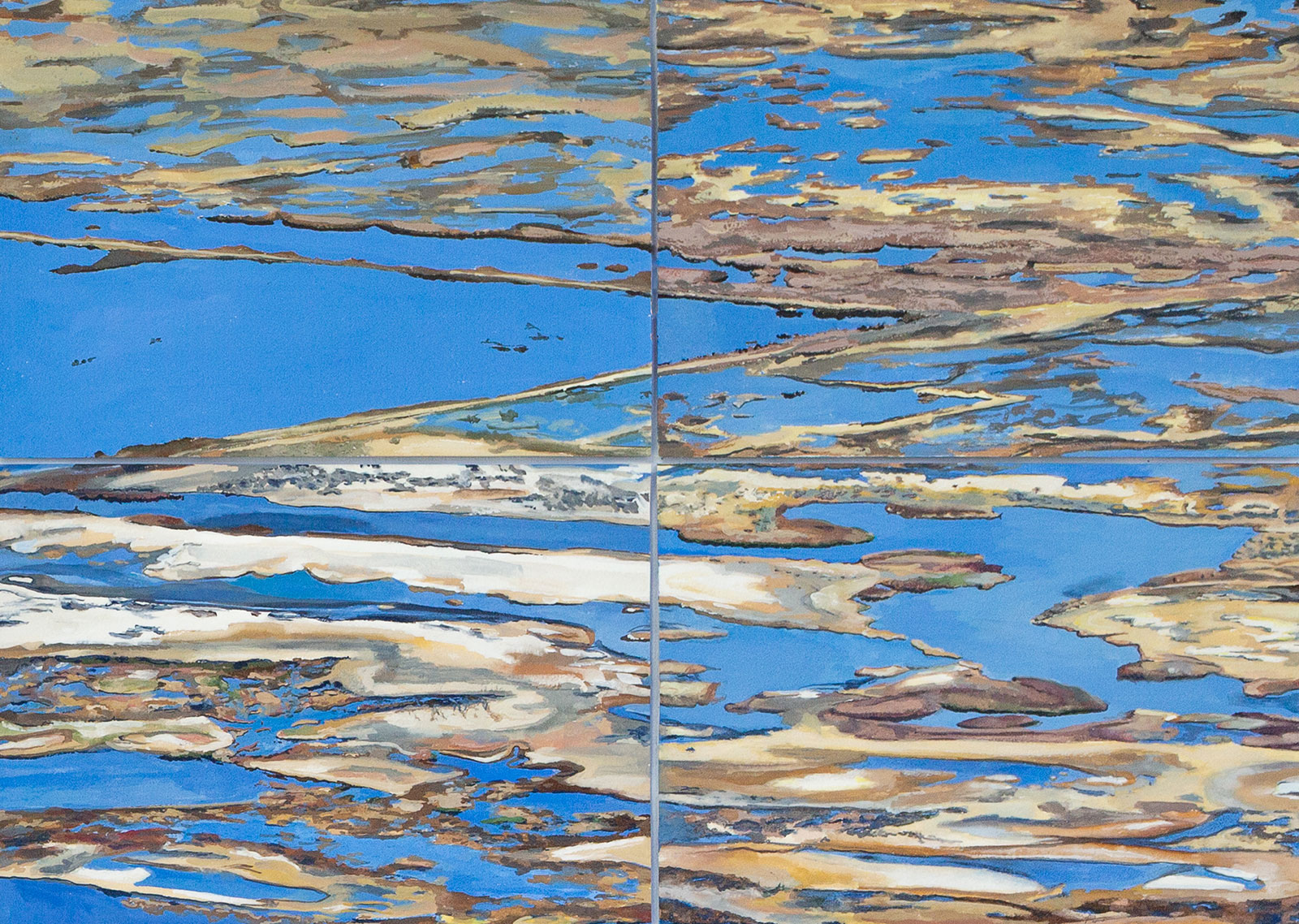
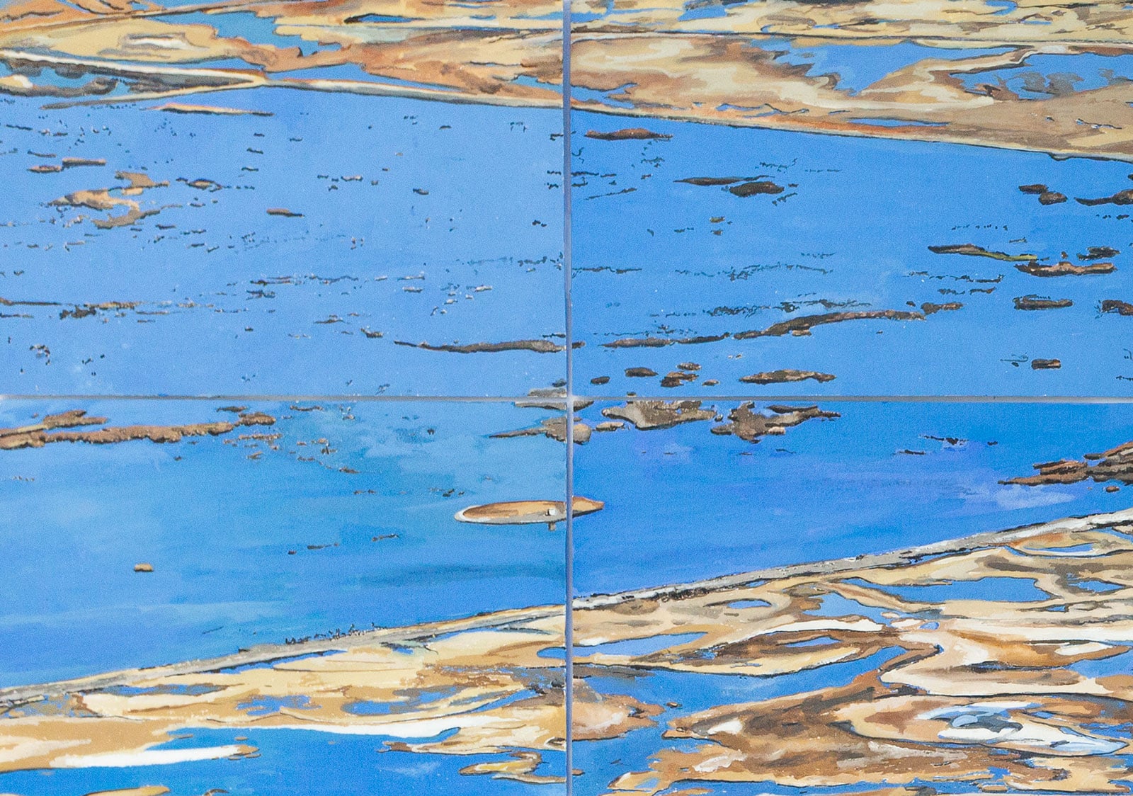
The juxtaposition of these shapes can be visually striking. Meditations on Geometries of Water: Summer Lake began to unfold as I stood, mesmerized, at the top of Winter Rim, a 3,000-foot escarpment that overlooks the organic and angular shapes crafted by Summer Lake, in south-central Oregon, and the human constructions that direct its water. After leaving the Great Basin, I spent months painting the colors and shapes as I had perceived them. And yet I had only an elementary understanding of what they signified.
The Oregon Outback is arid. Sage green and gold dominate the landscape. However, traveling deeper into it along straight and open roads you will encounter accents of bright green rings of alfalfa growing within angular plots of land surrounded by gray-green sagebrush. Even more unexpectedly, you may encounter silvery lakes and marshes, features I would not have associated with high desert ecosystems until I spent time at PLAYA, an art and science residency program at Summer Lake. The more I immersed myself in the landscape, the more evidence of water was revealed through the colors and shapes of the land.
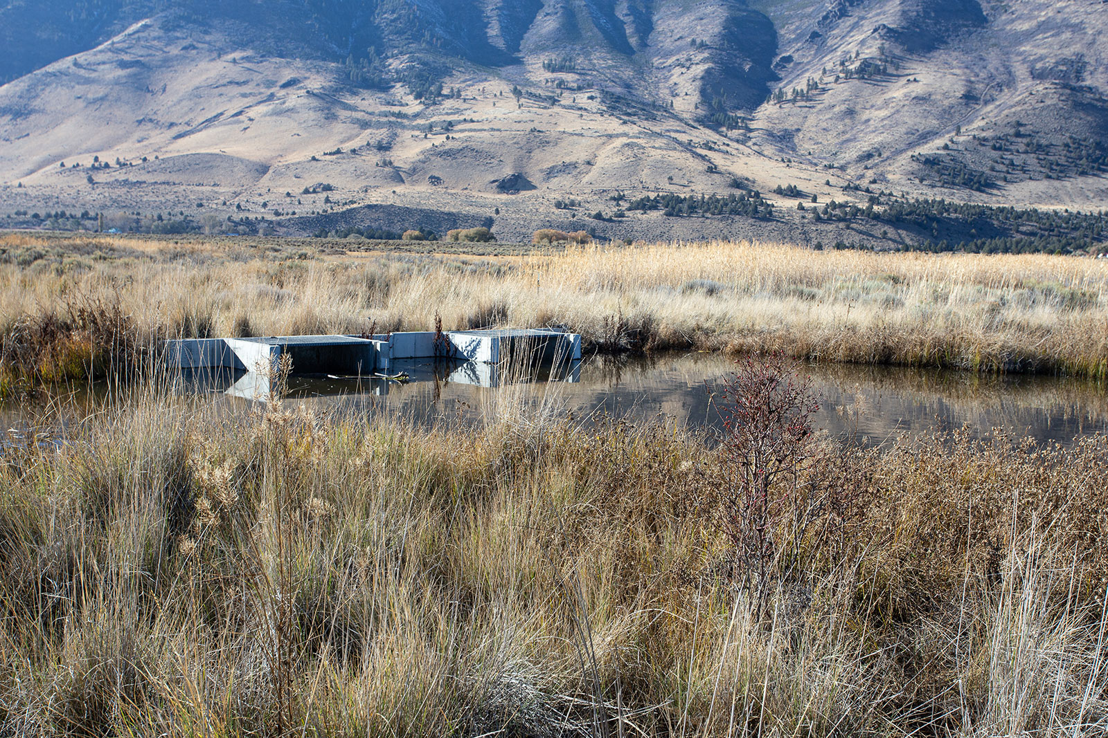
The average rainfall is a mere ten inches in the Great Basin of the Outback, one third that of the fertile South Willamette Valley where I live in Eugene, Oregon, roughly 150 miles northwest of Summer Lake. Where in this landscape, I wondered, does the water come from to grow alfalfa and fill lakes, and why is alfalfa grown in the isolated desert in the first place? And how is it that the marshes and lakes are so attractive to shore birds that thousands of them stop at Summer Lake’s bird sanctuary in the spring and fall during their migration along the Pacific Flyway? What sustains all this given the mere ten inches of rain over a year?
It’s a strange and beautiful land that I cannot say I understand well, even after spending time there with land and water specialists. The answers to my questions, I would learn, lie in a complex web that includes natural springs, cattle ranching, an aquifer, wildfires, a booming population of juniper trees, and more.
My ideas for art unfold incrementally long before they develop into paintings. First I need to spend time moving throughout the landscape, taking it in through all of my senses. I need to feel it by scrambling through underbrush, climbing trees, and swimming and floating in streams. I sit and listen, returning to places that interest me to see how they’ve changed over time. My impressions don’t take compositional form until I begin to frame colors, patterns, shapes, and rhythms with my camera. Back in my studio I comb through these photos looking for connections and compositions I can play with. I often create diptychs of a landscape from two different perspectives or periods of time. Only after a lot of playing around do I use paint, which connects my physical experience of the landscape with physical materials like pigments. Writing weaves throughout my process.
My participation in the PLAYA residency took place over ten days in October of 2023. We spent our days traveling to different sites with local specialists, attempting to grasp the interplay of fire and water affecting the Great Basin. The experts revealed fascinating insights, but their specialization fragmented my understanding of the landscape, its web of connections spun from a center revolving around water.
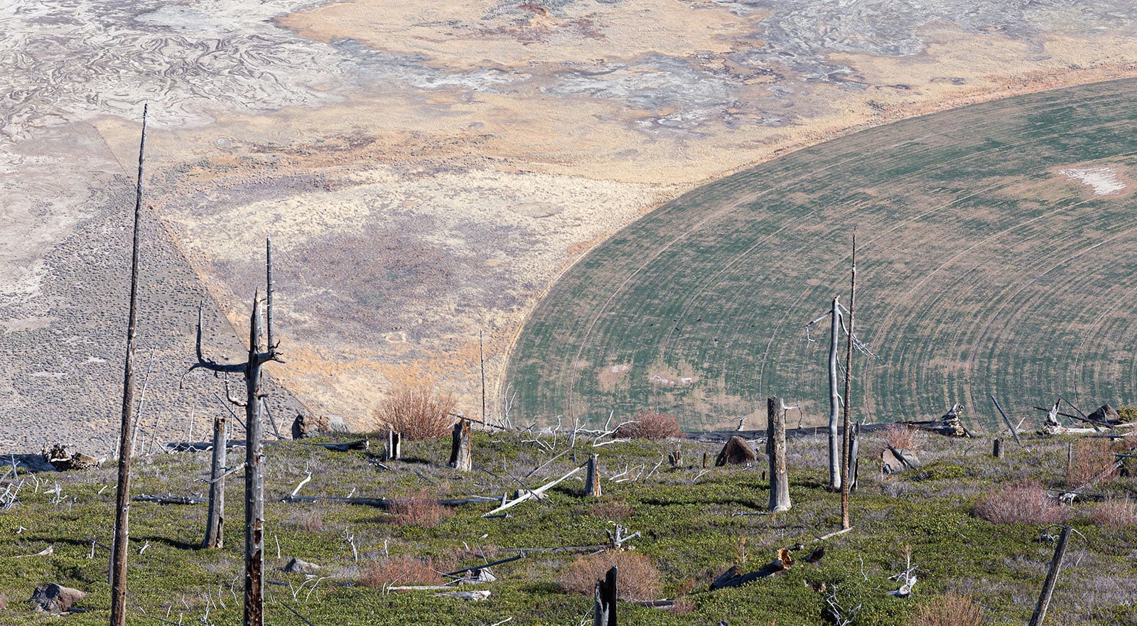
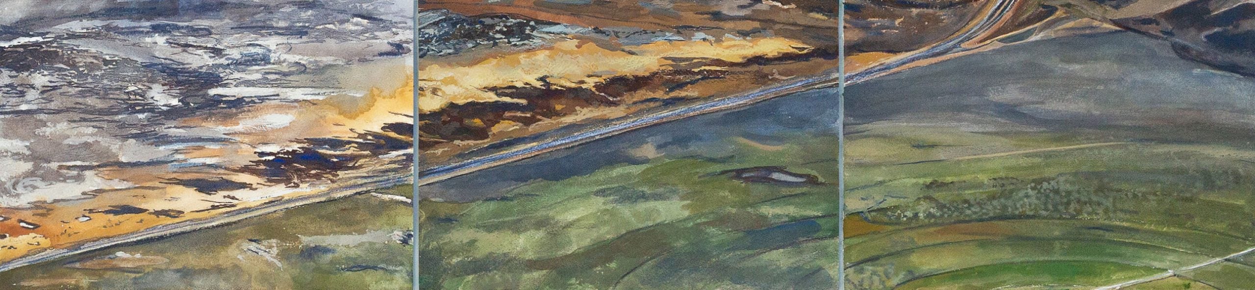
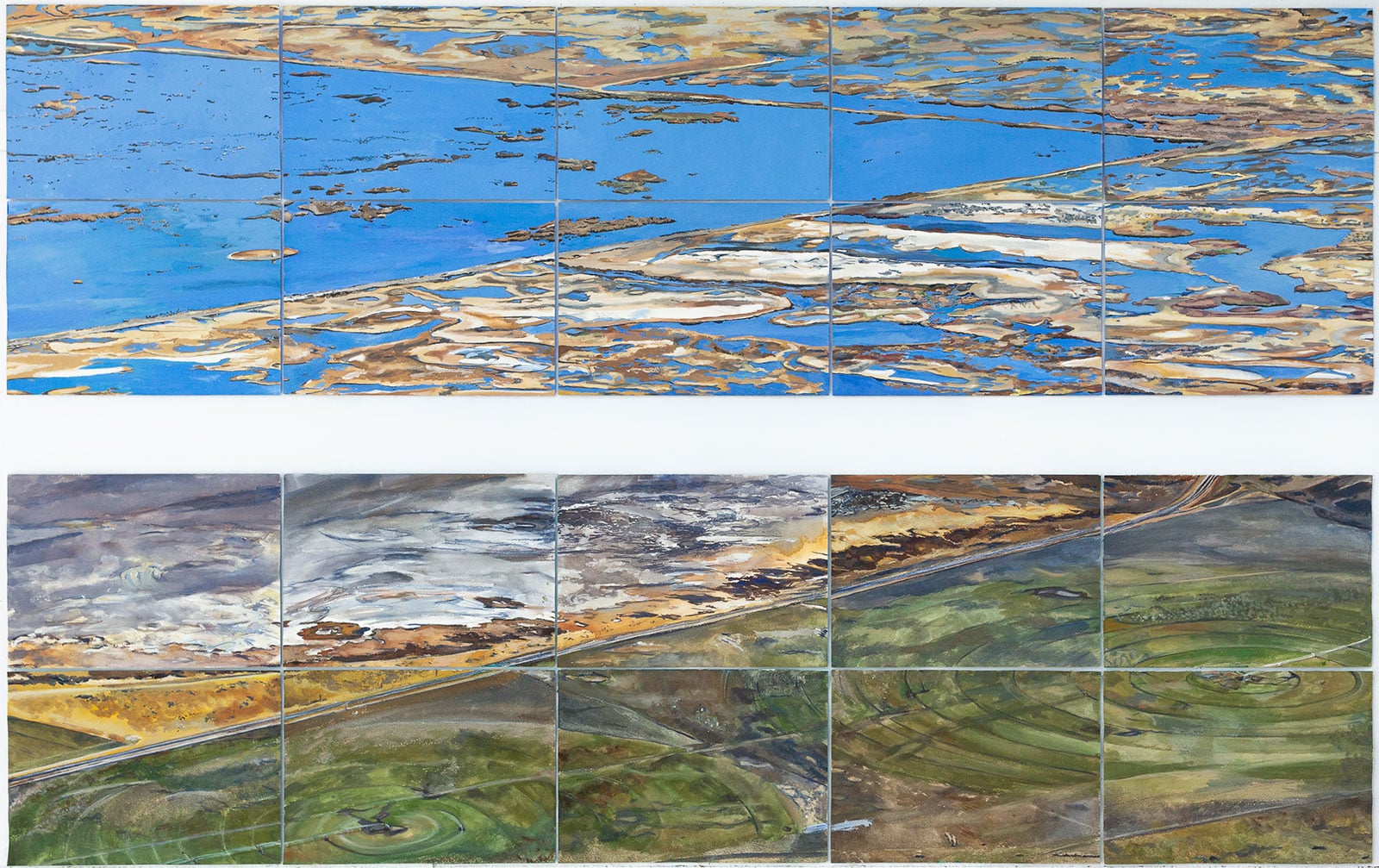
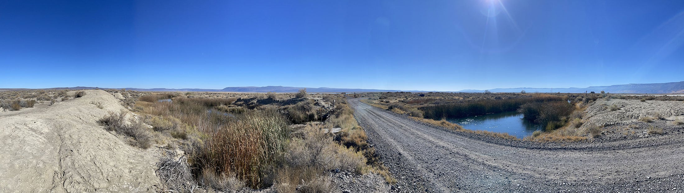
It was on a morning free of specialists that I ventured, with my cohort, to the edge of Winter Rim. Gazing through fire-blackened snags of junipers to the basin below, I could see the flat landscape unfold into bright green circles of short alfalfa. The landscape was bisected by a straight stretch of the two-lane highway I traveled to get to Summer Lake. On the other side of the road was a thin strip of desiccated golden brush beyond which were white and gray salt flats. Stretching beyond the salt was a wide expanse of shimmering bright blue water cut through with straight gold lines and punctuated by curvilinear blobs of salty white and gold islands.
Seven months later, in late May, we all returned to PLAYA with the artwork we had created to participate in a symposium for the local community. Some of the specialists we had spent time with came as well. Kids from nearby Paisley School walked from studio to studio to see how we outsiders responded to their homeland in our artwork. It was not until I listened to them discuss my paintings that I grasped some of the deeper meanings of the colors and shapes, and how local citizens could read them so differently from one another depending on what was salient to them.
As the schoolkids recognized specific shapes, they told me stories and shared their memories of the land. To my astonishment they correctly identified who owned the alfalfa fields after asking only one question: What month did the paintings depict? By looking at the color of the circles and connecting it to their knowledge of local water rights, they could decipher so much information embedded in my paintings.
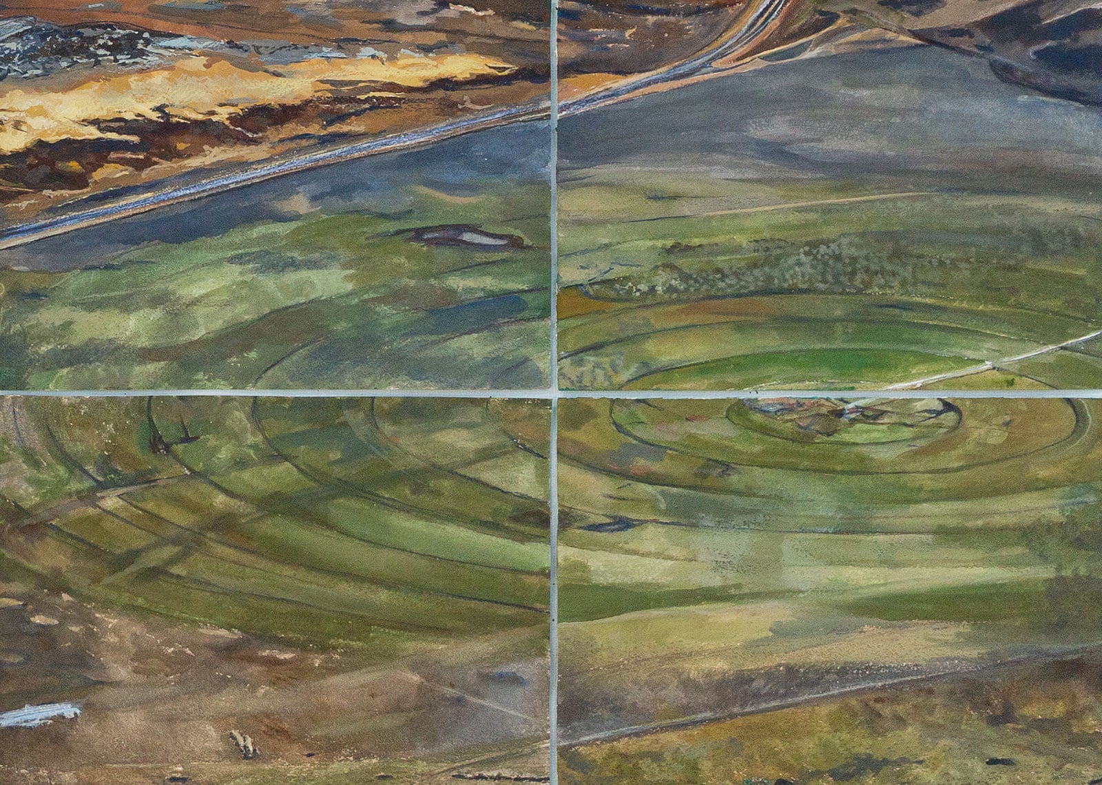
But the children’s stories, though detailed, were only about the green circles. The blue and gold shapes on the other side of the dividing line of the highway were not decipherable to them; they were meaningless abstract shapes. These kids were cattle ranchers’ kids and farmers’ kids who rarely, if ever, went to the bird sanctuary, descended upon twice a year by all those migrating shore birds. The rhythm of their lives was set by the annual timer of water rights and how it dictated alfalfa growth and cattle movement. It is a cyclical rhythm that includes circles inscribed in the land by a radius made from irrigation pivots drawing water from wells drilled deep into the aquifer.
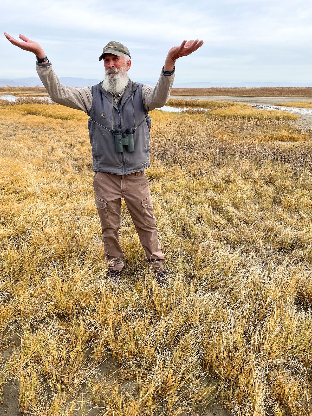
In contrast, Summer Lake’s former wildlife manager Marty St. Louis spent about an hour with my paintings telling me about both the geometric and organic blue and gold shapes. These were shapes Marty knew intimately from the decades he spent in Summer Lake’s marshes and dikes, just across the road from the green circles. Small shapes in the paintings that held no meaning to me became entry points for him into long reflections about bird habitat and water legislation.
The stories of the geometries of water and their colors were not just fragmented for me; they were segregated stories for the local community, separated by a line as clear as the straight road that runs between them. Though in reality, these stories are intertwined. Both sets of geometries of water are dependent on the water surfacing through wells and springs from the aquifer. Yet nobody has a clear story of the aquifer itself and the water it holds. That is the story that will determine the duration of the shapes and colors currently inscribed on the land, the shapes that hold significance for birds, ranchers, and farmers alike.
To complicate things, wildfires have increased in quantity and intensity—the intensity fueled, in part, by the encroaching groundwater-loving junipers that have changed the structure and habitat of the Great Basin sagebrush ecosystem. This contributes to how, and how much, the shapes change over time.
Straight lines and perfect circles are now steadily outpacing the complex curves of water as outdated water rights have mandated and encouraged efficiently moving more water out of the lake than the aquifer and spring provide. What will happen to the geometry of land and water when there is no longer enough water in the basin to create ever-changing sinuous curves?
About the Artist
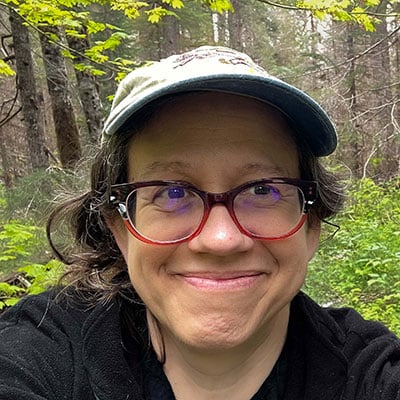 Leah Wilson is a visual artist, writer, educator, and outdoor enthusiast. She began interweaving her passion for rivers and whitewater kayaking into her creative practice in California’s Sierra Nevada foothills where she created a pivotal project influenced by the environmental decision-making processes of scientists, and stakeholders during the Federal Energy Relicensing Commission’s assessment the Yuba-Bear watershed. This experience and decades of wilderness exploration form the backbone that continues to inform her creative process. A 2012 artist residency at the H.J. Andrews Experimental Forest in the Oregon Cascades introduced her to ecologists working on long-term studies and field research. Attracted by the enduring focus of inquiry into a specific place, she is now an episodic lifetime artist-in-residence at the Andrews Forest. Leah makes her home is Eugene, Oregon and teaches at Oregon State University.
Find more of Leah’s work at www.leahwilson.com and on Instagram @leahcatherinewilson.
All images by Leah Wilson. Header image: Detail, Meditations on Geometries of Water: Summer Lake.