
By Deborah Fries
In Philadelphia, surface water is everywhere. Less than 65 miles from the Atlantic Ocean, the city is bracketed by rivers, built over buried streams, and at only 39 feet above sea level, geographically defined by its proximity to water. South of the city’s center, the Schuylkill River, which drains a watershed of about 2,000 square miles in eastern Pennsylvania—much of it in coal country—joins the Delaware River just northeast of the Philadelphia International Airport, where bottomlands and marshes have been filled with dredge spoils. Most of the airport’s terminals are only 15 feet above sea level.
Over centuries, a flood-prone built environment has encroached upon Delaware Estuary Coastal Zone topography. Flooding—from riverine, tidal, groundwater, and urban runoff sources—intensifies in the wake of severe storms and rising sea levels created by climate change. To adapt to changes that are already in the works, and based on 2000 sea levels, city planners are preparing for a rise of almost a foot by 2025 and more than four feet by 2075. Tidal rivers and even groundwater are affected by sea levels. In Philadelphia, climate change adaptation means preparing for a wetter future.
Philadelphia is getting wetter—and also, warmer. National Geographic projects that in less than 50 years, Philadelphia will feel like northeast Arkansas, with maximum summer average temperatures jumping from 84 to 93 degrees Fahrenheit. For the Philadelphia Water Department’s planners, warmer air temperatures indicate a need to prepare for seasonal low-flow conditions, decreased dissolved oxygen, a need for higher chlorination, and management of disinfection byproducts. While the creep of the salt front in the Delaware River is largely associated with low flow, and managed by releasing water from upstream reservoirs, rising sea levels also play a role in drawing salinity. The Delaware River Basin Commission has determined that the number of times the salt front in the Delaware River is predicted to be upstream of Chester, Pennsylvania (River Mile 83) or the mouth of the Schuylkill River (River Mile 92.5) is increasing with sea level rise. At present, the salt line is just 17.5 miles downstream from drinking water intakes. It’s essential that coastal cities prepare for big changes, and although Philadelphia does not have an Atlantic coastline, tidal influences from Delaware Bay impact the city and its rivers.
Philadelphia’s plans to reduce risks of climate change in areas of key vulnerability—flooding, heat impacts, and the increased costs of disaster response and operations—were reported by the Mayor’s Office of Sustainability in its 2015 report Growing Stronger: Toward a Climate Ready Philadelphia. The report’s climate adaptation strategies address the threats that a wetter, hotter city will pose to municipal infrastructure and service delivery. The multi-agency workgroup that convened to develop the report assessed the future needs of the Public Property, Fleet Management, Health, Parks and Recreation, Streets, and Water Departments, as well as the Philadelphia International Airport. By investing in these public assets, the City of Philadelphia is focused on adaptation options intended to protect its vulnerable populations. Many of the Philadelphia Water Department’s existing resiliency efforts support a climate-ready city, including a 25-year effort to manage stormwater, now ending its 12th year of implementation.
Even without flooding, stormwater moves over, under, and through the region. From its confluence with the Delaware River to the Fairmount Dam, the Schuylkill River is a tidal waterway that rises and falls by six feet twice per day. The tidal portion of the Delaware River—which experiences even more dramatic regular tides—extends from Trenton south to Cape May, New Jersey. While these large rivers and their tributaries delineate Philadelphia’s physical boundaries, there is an unseen network of historic surface water moving and redirected into a 200-year-old combined sewer system, beneath the city.
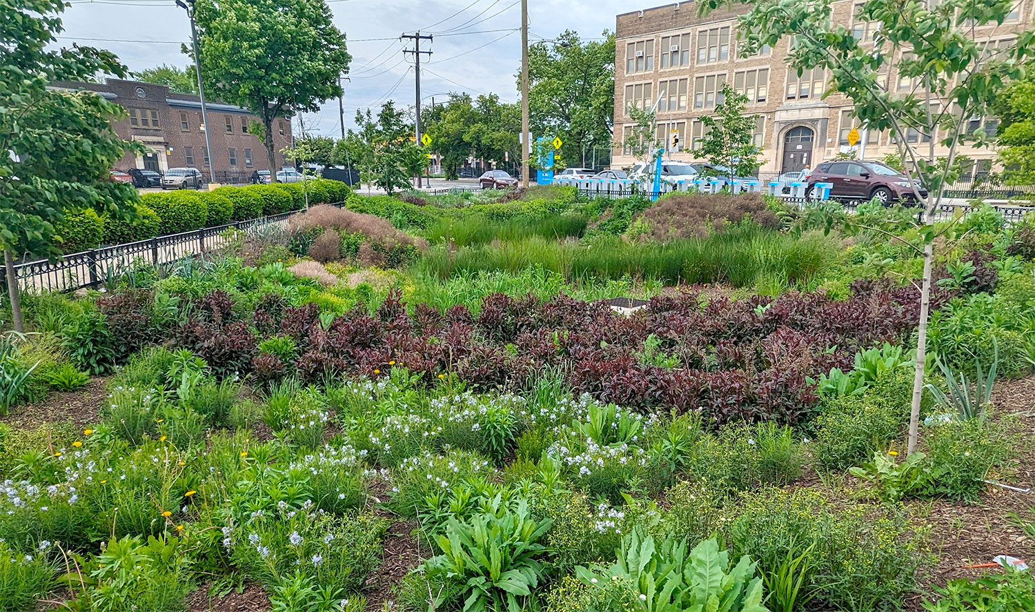
Photo courtesy Philadelphia Water Department.
Transporting wastewater and stormwater through combined sewer systems was an engineering marvel when the technology was introduced in 1855. The collective disposal of stormwater, human waste, and industrial waste directly into rivers and lakes must have seemed highly efficient to 19th-century city planners. Many major cities on the East Coast and in the Midwest adopted the technology. Modern waste disposal would be further refined with the addition of sewage treatment plants in the early 20th century, creating a sense of protected, safer surface water.
Yet, for the more than 700 cities in the U.S. that must control overflows from their combined sewer systems, the discharge of untreated wastewater is a major source of pollution. When substantial amounts of stormwater infiltrate a combined system, treatment plants are overwhelmed and bypassed, sending biological and chemical waste into our rivers. The U.S. Environmental Protection Agency reports that an estimated 850 billion gallons of untreated wastewater and stormwater are discharged annually to U.S. waterways.
For populations that rely on surface water for drinking, source water protection is imperative. The Philadelphia Water Department relies upon the Delaware and Schuylkill Rivers for drinking water for 1.7 million people in Philadelphia and lower Bucks County. Multiple existing threats to source water include agricultural runoff, land development, pollution from geese and other wildlife, illegal disposal into storm sewers, effluent dominance, and stormwater. The threats posed by industrial accidents can shut down surface withdrawals and affect an entire drinking water system. On March 25, 2023, an accidental release of more than 8,000 gallons of water-soluble latex into the Delaware River occurred at a chemical facility just 13 miles upstream from Philadelphia’s Baxter Water Treatment Plant. The plant, which supplies more than half of Philadelphia’s drinking water, closed its raw water intake for a day, and cautioned the public to use bottled water for drinking. Three days later, after continuous monitoring, Philadelphia’s mayor announced that the threat had passed and tap water was safe to drink.
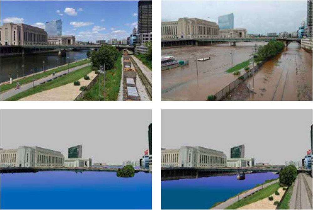
Image from Philadelphia Climate Action Playbook, courtesy City of Philadelphia Office of Sustainability.
But it’s not only these existing threats to source water that require planning for the integrity of drinking water in the near future: as climate change brings rising temperatures, its impacts to water quantity and quality must be considered.
The City of Philadelphia Office of Sustainability has identified increased precipitation/flooding and increased heat as the main dangers of climate change to Philadelphia—with underserved neighborhoods of color being particularly at risk for the worst effects, including flooding, displacement, heat-related illness, and respiratory diseases. While the city cannot control sea levels or weather, there are measures that it can take to strengthen climate resilience for its residents. One of its most successful adaptive initiatives—now concluding its 12th year of implementation—was developed as a regulatory response to the environmental damage created by combined sewers.
Since 1994, EPA has used policy, guidance, and the regulatory power of the Clean Water Act to mitigate the damages that combined sewer overflows cause in the nation’s waterways. Outfalls must be permitted by an enforceable mechanism, and municipalities must develop long-term control plans that can be implemented in phases. With 164 permitted combined sewer outfalls, in 2011, the City of Philadelphia entered into a consent order and agreement (CO&A) with EPA and the Pennsylvania Department of Environmental Protection to meet Clean Water Act milestones over a 25-year period, achieving an 85 percent reduction in pollutants. This innovative long-term control plan, called Green City, Clean Waters (GCCW), relies heavily on green infrastructure to annually reduce more than three billion gallons of pollution in the Delaware and Schuylkill Rivers—Philadelphia’s drinking water sources.
Philadelphia is one of five forerunner cities[1] in implementing green infrastructure in the nation and the first to meet both state and federal water quality mandates through green interventions. Its Green City, Clean Waters plan has attracted national and international attention, including the American Planning Association 2015 National Planning Excellence Award for Implementation, and generated a substantial number of publications and visitors. In the spring of 2022, outreach specialists from the Philadelphia Water Department gave Terrain.org a guided tour of three green stormwater infrastructure (GSI) projects.
Photo by Simmons Buntin.
A Private Investment in GSI: Penn Park
Our tour began on the University of Pennsylvania campus, where green stormwater infrastructure has been implemented in Penn Park, a rolling 24-acre open space that is home to athletic fields, a stadium, tennis structure, and other sports amenities. As part of the university’s Penn Connects master plan, this once unappealing space has been transformed, and its design incorporates green infrastructure that exceeds GCCW stormwater absorption requirements. This project diverts two million gallons of stormwater from the city’s sewers annually.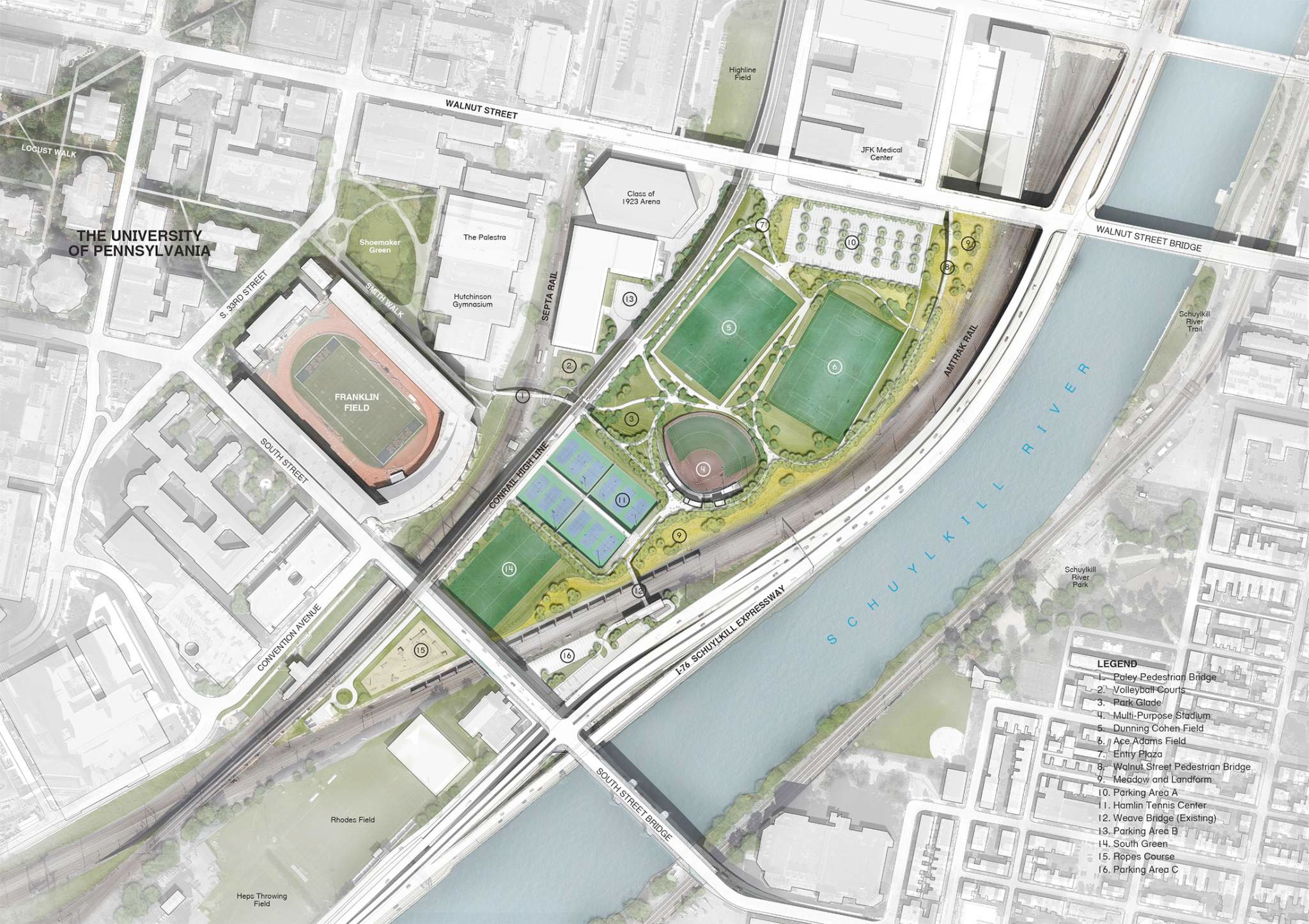
Image courtesy Michael Van Valkenburgh Associates, Inc.
Working closely with the city, Penn’s investment in stormwater management was designed to include bioswales, rain gardens, and meadow plantings that capture rainwater and enhance a meadow aesthetic, along with a 300,000-gallon cistern and underground infrastructure that collects runoff from porous turf fields. The green design of Penn Park also included nearly 570 new trees. What was once a fenced-off surplus property of the U.S. Postal Service has become a visual link between the campus and Center City, as well as a venue for student and faculty environmental research and pilot projects.
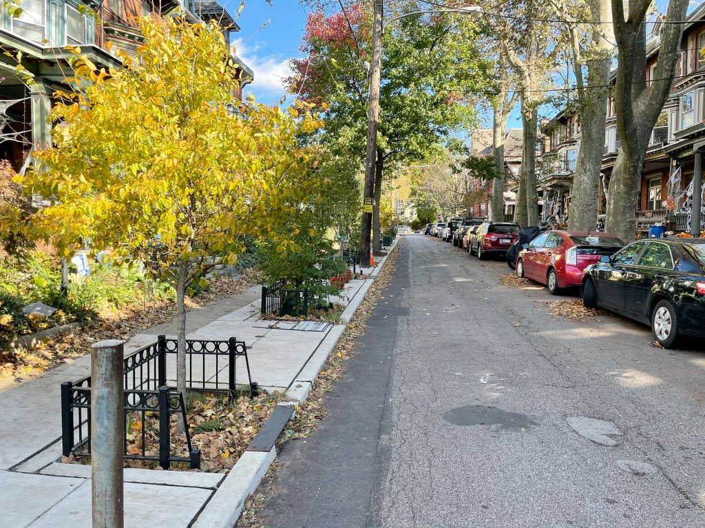
Photo courtesy Philadelphia Department of Water.
A Public Investment in GSI: Osage Avenue
While large-scale projects such as Penn Park can manage impactful amounts of stormwater, many of Philadelphia’s 293 completed public investments in green stormwater infrastructure are neighborhood projects that incorporate smaller infiltration tools, such as tree trenches, rain gardens, planters, and vegetated curb bump-outs. Dan Schupsky, who heads the Water Department’s public engagement team for GCCW, took us next to a West Philadelphia neighborhood where a single block of residents had collaboratively introduced green tools.Public involvement plays a significant role in facilitating the adoption of green stormwater infrastructure, even at the micro level. Philadelphia is not a sponge city, designed to maximize stormwater infiltration. It is a 340-year-old metropolis that has colonial remnants, including narrow, cobbled streets in Old City, along with heavily paved, post-war neighborhoods in the Northeast, within its 135-square-mile area. It has lush parks and heat islands, diverse topography, and communities. The adoption of GSI is regulatory-driven and to engage a Philadelphia neighborhood in a public project is to build awareness of shared environmental issues.
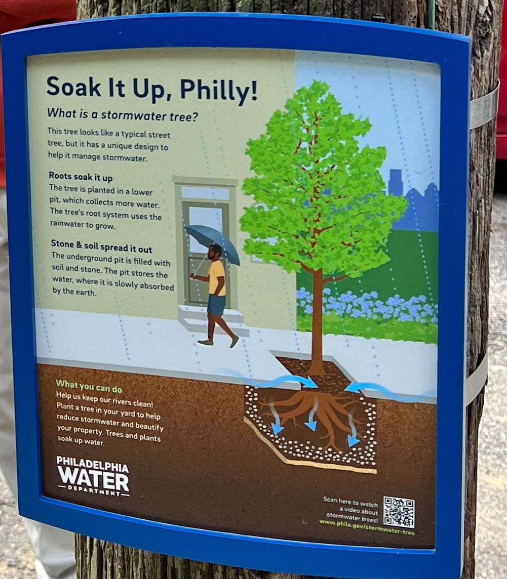
Photo by Simmons Buntin.
That’s what happened on the 4200 block of Osage Avenue in Philadelphia’s Spruce Hill neighborhood, where GCCW outreach staff met with residents for nearly four years, as the adoption of green infrastructure went through design and construction phases. The primary GSI tool used in this pilot project was the installation of 11 stormwater tree systems, a process that plants trees in a trench and connects them to an underground infiltration structure. Tree trenches are engineered to manage incoming runoff, inspiring some residents to incorporate smaller tools—such as flow-through planters and rain barrels— to augment the local management of stormwater.
Completed in 2019, the tools used by Philadelphia Water Department to increase stormwater infiltration on Osage Avenue require ongoing maintenance. And although the department has the city-wide responsibility for post-construction maintenance, residents often do their part in day-to-day management of local installations, removing litter that collects in rain gardens and vegetated bump-outs, which are curb extensions that protrude into the street and direct stormwater into an inlet. Usually constructed at intersections or mid-block, they feature shorter plantings that will not obstruct traffic sight lines.
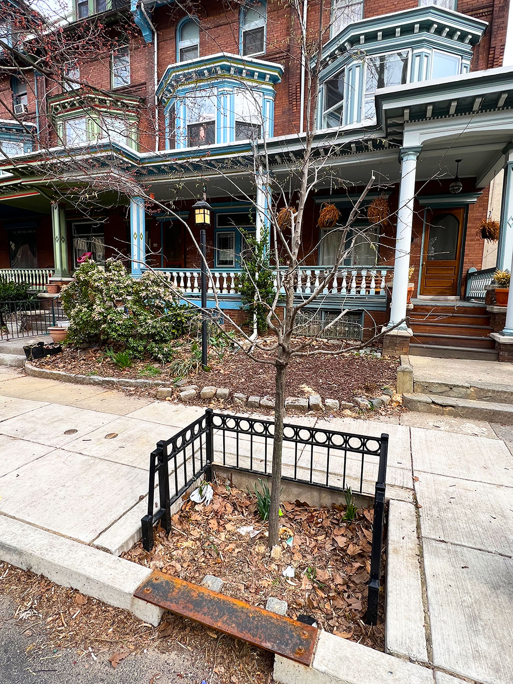
Photo by Simmons Buntin.
A rain garden is usually created in a depression, graded to collect water from impervious areas, and lined with subsurface stone to manage infiltration. Rain gardens are planted with native species of shrubs, perennials, ferns, and trees that will use the ponded water. In the Mid-Atlantic, a wide variety of native plants may be used in rain garden design.
These small tools have a cumulative effect, as they collect runoff and allow it to infiltrate within 72 hours.

Photo by Simmons Buntin.
A Public Partnership in a Historic Asset: Centennial Commons
Our last site visit was Centennial Commons, a remnant of one of Philadelphia’s most interesting historic sites. Developed as a morale-building event for a nation reeling in the aftermath of the Civil War, Reconstruction, and two decades of industrial depression, the Centennial Exhibition—which attracted nine million visitors over its six months of public existence—is considered the first World’s Fair. It was both a celebration of the country’s 100th birthday and American exceptionalism, from art to agriculture. Today, the Smith Memorial Arch, once a gateway to the Exhibition, is the gateway to the 1,400-acre West Fairmount Park, and a demonstration of five acres of stormwater management.Fairmount Park Conservancy, Philadelphia Parks and Recreation, and the design experience of PennPraxis joined together with the Philadelphia Water Department to create a plan that included the installation of seven rain gardens, a stormwater basin, 68 new trees, and 42 species of plants. The green infrastructure that has been implemented in this five-acre site can divert nearly 160,000 gallons of stormwater in a typical storm event.
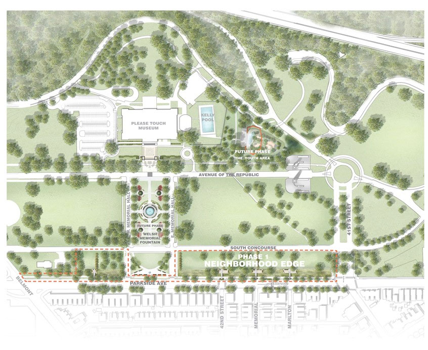
Image courtesy Fairmount Park Conservancy.
Completed in the spring of 2018, this GCCW project incorporates green infrastructure within a larger effort to revitalize a neglected public space. Although an earlier, ambitious primary plan to restore amenities and accessibility to parts of West Fairmount Park could not be funded, the desire to create welcoming neighborhood spaces remained. In 2014, the Fairmount Park Conservancy partnered with PennPraxis to begin work on a new plan, Reimagining the Civic Commons—a concept that began in Philadelphia and has spread across the country, as planners recognize the value of creating public spaces where everyone belongs.
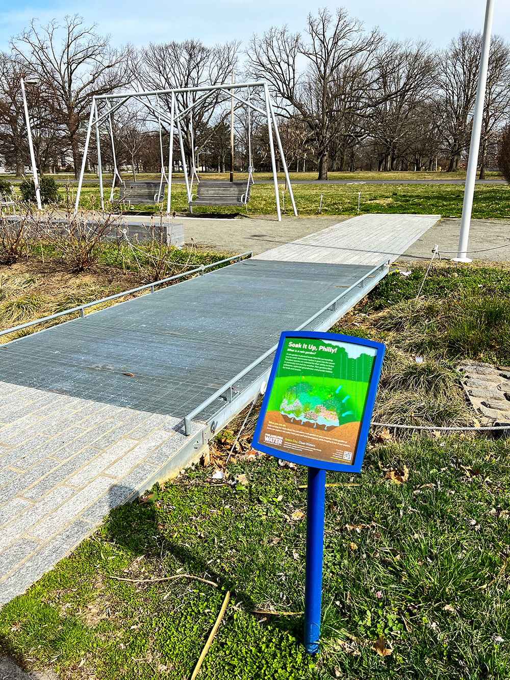
Photo by Simmons Buntin.
The Fairmount Park Conservancy was selected to be the convenor of the new plan. In December 2014, the influential William Penn Foundation led a pilot effort to create a Civic Commons Collective, which resulted in a three-year $5,442,500 grant from the Knight Foundation to convene and invest in the Civic Commons Collective. The William Penn Foundation is known for its commitment to the development of accessible and vibrant public spaces and protecting the Delaware River watershed, as well as fostering greater social and economic integration and opportunities.
Embracing the same values, the Conservancy wanted the adjacent East Parkside residents to have a public space that uses the “neighborhood room” model, inspired by the big porches of the houses across the street from the park. Designers sought to replicate that kind of space within the park with the addition of porch swings and benches, creating places for people to eat, play, and convene. In addition to creating welcoming amenities, a key design issue was managing stormwater runoff from the grounds, given its proximity to the Schuylkill River. Green stormwater infrastructure was used not only to contain runoff, but to create gardens that can be enjoyed by the neighbors on Parkside Avenue who face the park.
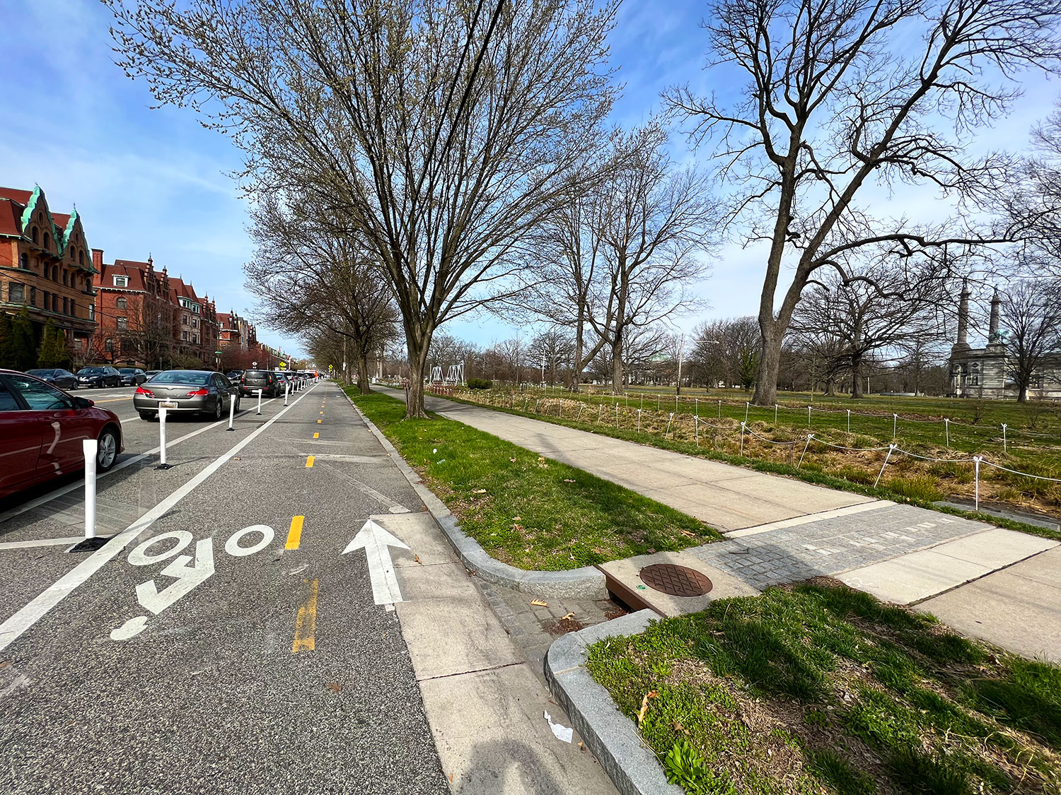
Photo by Simmons Buntin.
Stormwater and Flood Management as Climate Change Resilience
These projects demonstrate a range of implementation options that GCCW has offered residents and businesses to meet Philadelphia’s legal obligation for water quality standards, and, in turn, support climate change resilience. As a Mid-Atlantic urban area that can expect higher air temperatures, rising sea levels, increased rain, and extreme storms, Philadelphia cannot afford to ignore stormwater management. Even without a regulatory requirement, the city recognizes that the tidal salt line must be kept below its drinking water intakes on the Delaware River and that storm runoff and flooding must be controlled to protect both its citizens and its drinking water supply.Stormwater fees, assessed monthly on all properties in the City of Philadelphia, help to recover the cost the city incurs for managing stormwater. Fees are set as a flat rate for residential properties and based on the size of a property and its impervious surface for non-residential use. But fees won’t offset the flow of contaminated water from combined sewer outfalls into Philadelphia’s rivers. Project by project, green traditional infrastructure will be needed to absorb the first 1.5 inches of any rain event, a modest concession to a hotter, wetter Philadelphia.
Combined sewer overflows that threaten drinking water are not the only concern that stormwater presents. In its 2020 national flood risk assessment, the nonprofit First Street Foundation identified Philadelphia as having the state’s highest number of at-risk properties: 53,400 in 2020, expected to rise 14 percent by 2050. Nationally, Philadelphia ranks eighth in properties at risk for flooding. Just as flooding threat is expressed in areas exposed, Philadelphia’s GSI plan uses “acres greened”—in addition to gallons of stormwater diverted from the sewer system—to quantify the success of implemented green tools. The goal of GCCW and its many partners is to reach a final goal of 9,564 greened acres by 2036. The Department’s latest public numbers indicate that by installing more than 2,800 green tools at nearly 800 sites, their goal is within reach. These projects are credited with keeping more than three billion gallons of polluted water out of local rivers.
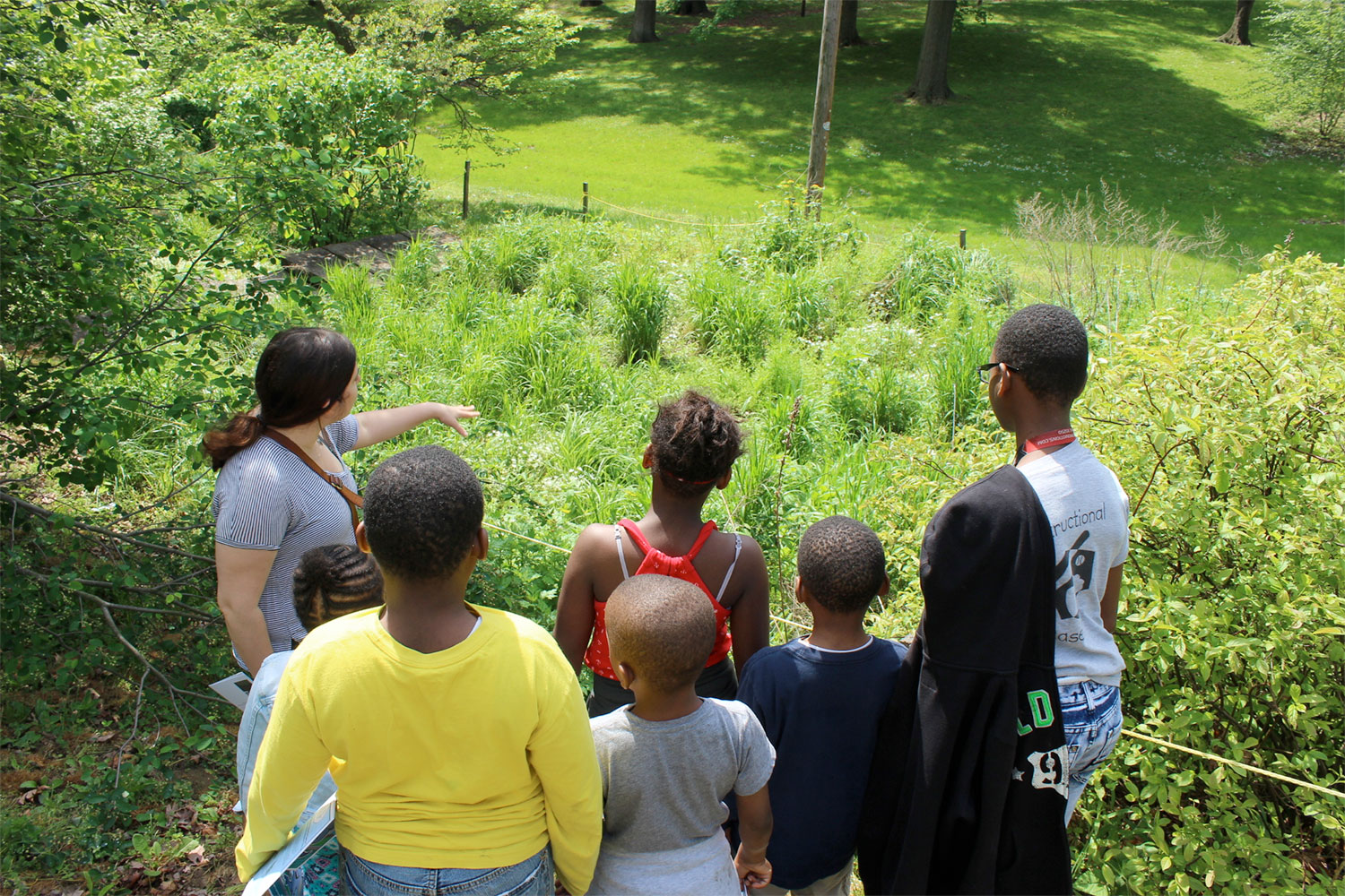
Photo courtesy Philadelphia Department of Water.
The use of green stormwater infrastructure to meet clean water goals—rather than deep tunnel projects like those used in Milwaukee and Chicago to prevent raw sewage from entering Lake Michigan—helps to meet other sustainability goals in Philadelphia. Vegetated spaces, whether created through GCCW projects or the City’s strategic tree planting programs or through the efforts of nonprofit groups and residents, create attractive neighborhoods that promote business and recreation, improved home values, and cooler, healthier spaces.
Using a strategic framework that outlines critical actions needed to sustain the level of effort required to meet regulatory compliance targets, the GCCW framework is more than metrics and feasibility. It is dedicated to a structure that recognizes how partner priorities, community needs, racial equity, environmental justice, and climate resilience play a critical role in decision making. Almost halfway through its plan, Philadelphia’s Green City, Clean Waters initiative not only diverts stormwater, it enhances social and climate resilience in the sixth largest urban area in the nation.
Today, thanks to the vision of its leaders and residents, Philadelphia is greener, the water cleaner.
[1] Liu, Li, and Marina Bergen Jensen. “Green Infrastructure for Sustainable Urban Water Management: Practices of Five Forerunner Cities.” Cities 74 (2018): 126–33. doi:10.1016/J.CITIES.2017.11.013.
 Deborah Fries is an editorial board member and contributor to Terrain.org. For more than two decades, she was a public information officer for transportation and environmental agencies. Today, she is a poet, writer, editor, printmaker, and the author of two books of poetry published by Kore Press, Tucson, and a chapbook, published by Seven Kitchens Press. Her online chapbook, Expedition, forthcoming in Terrain.org, combines her love of words and images. She lives in the East Falls section of Philadelphia on a bluff above the Schuylkill River.
Read more by Deborah Fries appearing in Terrain.org.
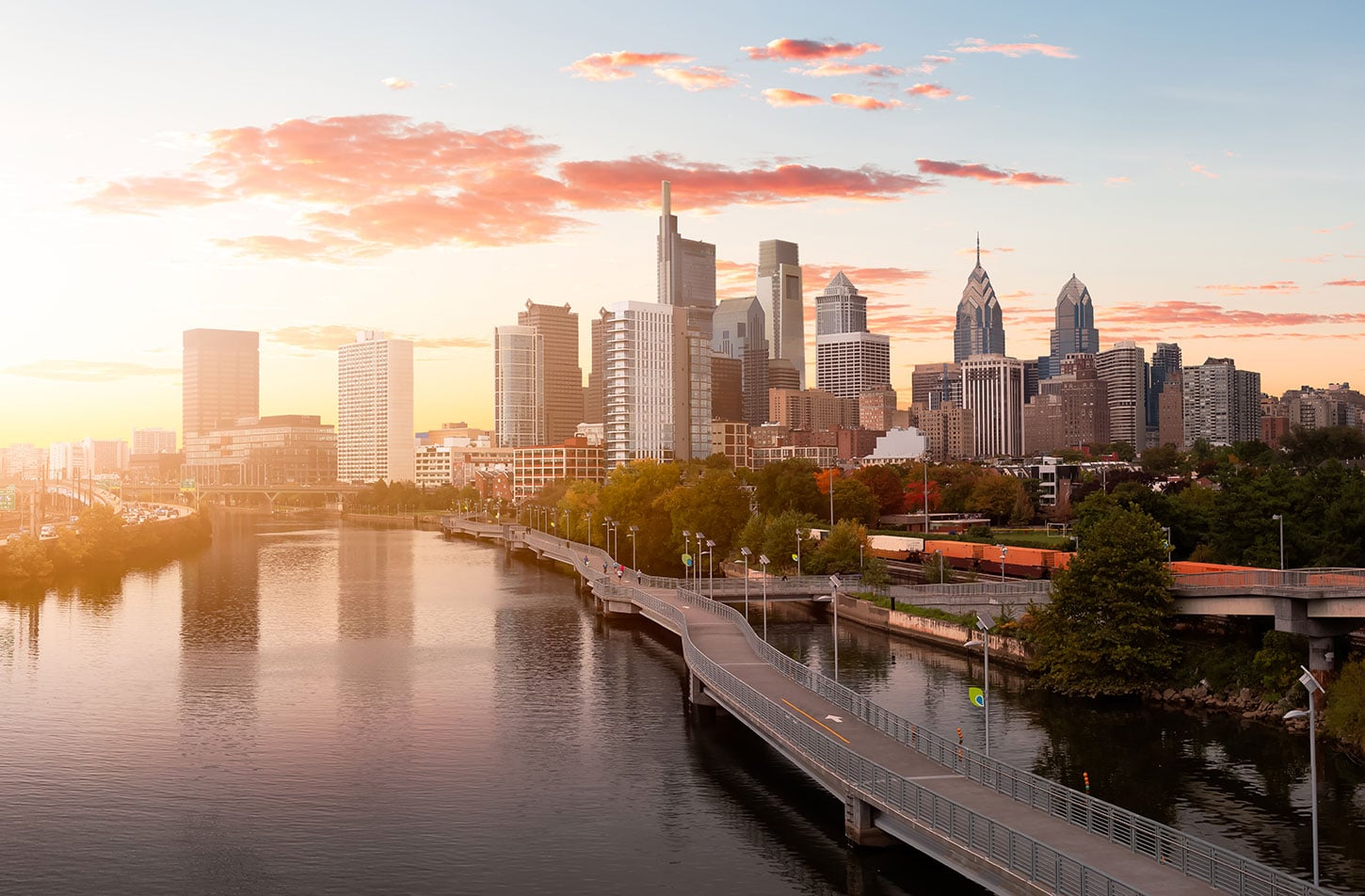
Header photo of downtown Philadelphia skyline by EB Adventure Photography, courtesy Shutterstock.