
Record numbers of nature-loving Americans are moving into the woods. What happens when lightning strikes?
The sky rained ash that summer. Wildfires had ringed Montana’s Bitterroot Valley for months, burning hundreds of thousands of acres and forcing residents to flee. By the time the heat peaked in early August 2000, the blaze was pushing smoke columns 30,000 feet above Ravalli County and generating winds that blew firebrands for miles. Aside from scorching 365,000 acres of the Northern Rockies, exhausting national firefighting resources, and contributing to a Western fire season that remains one of the worst on record, the Bitterroot disaster also produced what may be the most iconic wildfire photograph ever taken:
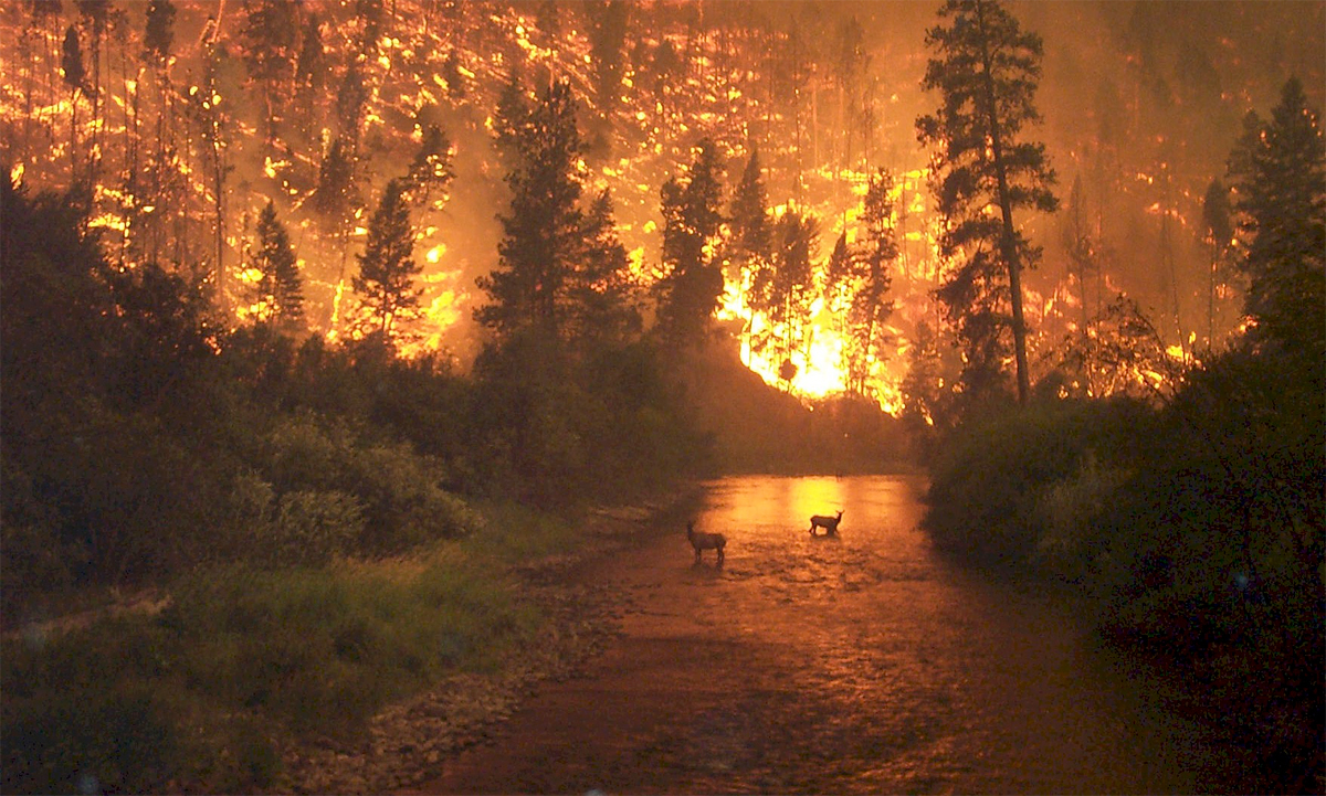
It’s an unforgettable shot: Two elk stand midstream, the burning hills behind them casting a hellish orange reflection onto the river, the sky dark, the green pines in perhaps their last living moments. The scene appears primordial, a timeless spectacle; nature at its reddest. But it’s not an image of deep wilderness. Just beyond the frame, man was everywhere. The fire behavior analyst who took the image did so from a highway bridge. Downstream from the wildlife, domestic sheep sheltered in the river. All of it—the glowing flames, the photographer, the frightened animals—could be seen from a house nearby.
The existence of that house and of thousands of others in similar neighborhoods across the West is radically changing the way firefighters work and the way forests are managed. Forty-four million houses—triple the amount in 1940—now occupy the wildland-urban interface, fire jargon for the area where private development meets public land. Demographers expect that number to swell by another 40 percent within the next two decades. Combine that with predictions for bigger, more frequent burns driven by global warming and the fire forecast grows dire.
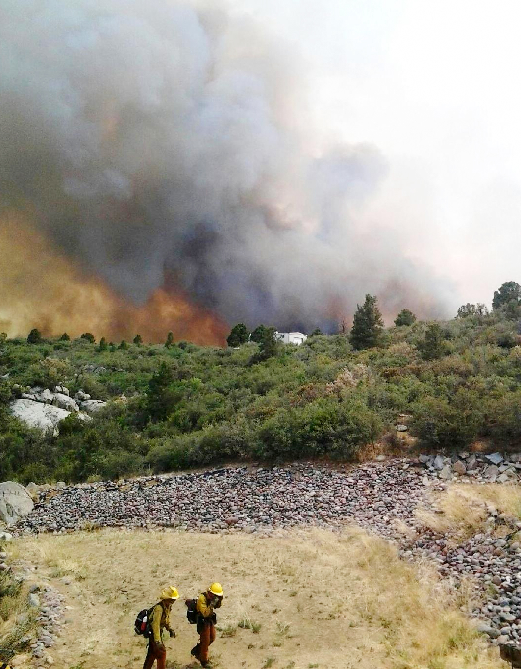
Photo courtesy U.S. Forest Service.
Climate change has at least entered the public conversation about wilderness, but far fewer Americans and policymakers acknowledge how development contributes to conflagrations that will grow increasingly costly, dangerous, and complex. Protecting houses that border public land is tricky. Firefighting in the woods has known hazards: water and food shortages, rugged terrain, the possibility of injury far from a hospital. But the border zone between forest and city presents countless variables—gas and electric lines, dead ends, erratic drivers—that heighten the danger. Then there’s the price tag. Federal land managers have estimated that saving private property accounts for between 50 and 95 percent of the rise in firefighting costs.
This summer provided a vivid reminder of what’s at stake. First, Colorado’s Black Forest Fire, near Colorado Springs, razed 486 homes and killed two people. Their bodies were found inside a garage, where their last minutes had likely been spent in a desperate bid to outrun the flames. Next, 19 members of the Granite Mountain Hotshots, an elite crew of wildland firefighters, died trying to contain a wildfire encroaching on the town of Yarnell, Arizona. Their fire chief told reporters the men died “protecting property.”
The tricky part, when it comes to saving lives and neighborhoods, is that we’re relying on individual communities to act with foresight and responsibility. The question is: How well are we doing to prepare for the threat? Three years ago, a decade after the Bitterroot fires, I went to Ravalli County to try to find out.
R]avalli County lies south of Missoula in the Bitterroot Valley, a grassy expanse cut by a curving river and flanked by the Bitterroot and Sapphire mountains. Millions of acres of public land stretch beyond both ranges, with the valley jutting between the high country like a peninsula. In late July, the peaks turn purple at dusk and fresh bales of hay dot the farm fields. Residents can be at trailheads within minutes. Sometimes they awake to find deer curled on front lawns.
Those natural attractions helped Ravalli become one of the fastest-growing counties in the U.S. during the 1990s. As its population doubled to about 40,000, logging and ranching gave way to retirement and vacation homes, and to bedroom communities serving Missoula. Working ranches now share the valley with trophy ranches—and with the Stock Farm Club, a gated golf course development with million-dollar homes designed to look like farmhouses.
Most subdivisions, however, are smaller, ad-hoc affairs. Leave the main highway and miniature suburbias materialize along gravel roads like cul-de-sacs airdropped from Southern California. Upslope, the valley gives way to five-acre lots shaded by evergreens. “Privacy in the Pines,” as one real estate circular put it.
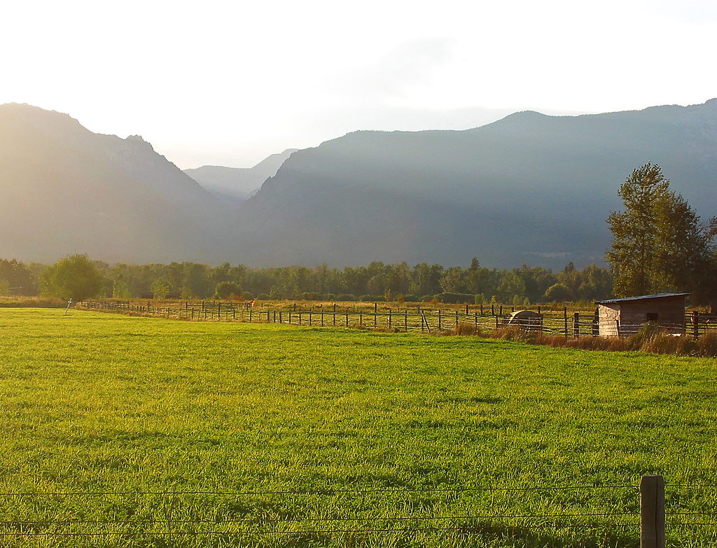
Photo by pfly, courtesy photopin cc.
The spectacular setting comes with a catch—many of these pine-shaded houses lie in the wildfire equivalent of a flood plain. Trees burn, of course. But fire will happily flit across the dry grasses too. Before white settlers arrived, wildfires scorched 30,000 acres of these low lands every summer, sweeping across the valley floor in orange waves. Lightning usually starts fires at higher elevations, and any summer storm in the Rockies has the potential to produce a fire that comes roaring down the mountains.
Perhaps no one thinks about this more than Byron Bonney, a retired fire behavior analyst who works part-time educating homeowners about the wildland-urban interface and administering small federal grants to those who want to invest in making their property more fire-resistant. During the week in which I climbed in Bonney’s Ford F-150 for a tour of at-risk neighborhoods, around a dozen fires had been extinguished in the wildland-urban interface. With his measured speech and elk head belt buckle, Bonney could have passed for a local rancher. But his life’s work has revolved around fire. The summer of 2010 marked his 42nd fire season. He’d started as a smokejumper in the ‘60s and worked his way up the Forest Service ladder.
Normally, he drives from door to door, trying to persuade property owners to take some basic steps—trimming low-hanging branches, for example—to mitigate damage if a burn comes. Some have no clue they’re at risk, which isn’t as unusual as it sounds. A Forest Service study in Colorado found that lovely-yet-dangerous topography—such as a ridge or foothills—only increases a property’s desirability. Buyers underestimated their chances of getting caught in a wildfire. And when they decided to buy a house in a dicey location, only slightly more than a quarter realized that the neighborhood they would call home was highly susceptible to wildfires.
We drove south along the valley floor and turned west onto Roaring Lion Road, passing irrigated farm fields before going into the woods where homes with wide decks sat beneath ponderosa pines. “See how all these trees and canopy are touching?” Bonney asked, pointing to a log cabin with a satellite dish on the roof. “If a fire moves down through here because of wind, even if you clean things up on the ground, fire is going to move through here.”
We passed houses with colossal picture windows, and he pointed out stumps (good) and snags (bad), deciduous bushes (good) and pine tree “privacy curtains” (bad). Each factor affects a house’s shot at surviving a moderate-intensity wildfire where embers, rather than walls of flame, often destroy buildings. A shake roof, a woodpile too close to outer walls: the ember finds the fuel and feeds.

Moderate Resolution Imaging Spectrometer Aqua satellite photo courtesy NASA.
When we circled back to the highway and its clear view of the slopes, Bonney began pointing at dark spots on the mountains. “There’s the Rock Creek Fire from 1988,” he said, gesturing to a canyon. “It burned again in 2005.” He tilted his head eastward: “That was the Bear Creek Fire.”
The grass had been green two weeks earlier, but in the normal summer pattern of the Rockies, the surrounding hills were now brown: “They’re just primed, ready to go again.” All they needed was a little dry lightning, responsible for Rockies wildfires since the Pleistocene era, or some human help—an unattended campfire, or even a spark from a careless bullet. “I’ve seen a lot of turmoil around fire—homes destroyed, deaths,” Bonney said. “Anything we can do to help protect people, we need to do that.”
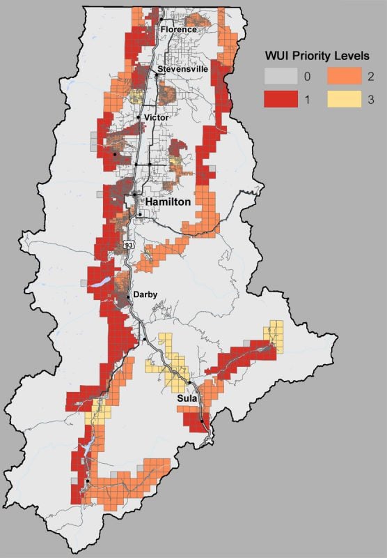
A few months earlier, he had done something he thought might help. Bonney had helped develop a map that identified the valley’s wildland-urban interface. Towns in the middle of the valley had little risk compared with densely treed neighborhoods like the one on Roaring Lion Road. Byron hoped those distinctions would raise awareness. With a glance, anyone could see the degree of risk they faced from wildfire. Here was a modest tool, he thought, to help save lives. When Bonney and his collaborators finished, they handed the map to county commissioners for approval. Considering that state law required counties to map their wildland-urban interfaces—a bid to minimize skyrocketing firefighting costs—and the fact that many residents remember the terrifying fires of 2000 all too well, commissioners might have expected little opposition.
Instead, irate residents packed planning commission meetings. Even before city planners linked the map to modest regulation proposals, such as requiring adequate escape routes and fireproof signs, residents began to question what everybody called the “WUI” map. (The acronym is pronounced WOO’-ee.) If land fell within the WUI, would that hurt property values? If your land fell within an area that had been deemed a fire risk, would it drive up the price of insurance? Would it prevent farmers from subdividing their fields?
Rumors spread. One whisper claimed the mapmakers had tricked the local fire chiefs into providing assistance. The WUI became a hotly debated issue in the local campaign for county commissioners. Property rights activists were incensed. In the county seat of Hamilton, a billboard outside Republican Party headquarters read, “Are you in the WUI? Stop back door zoning. Vote Republican.” How could a simple map—especially one that might keep people safe—generate so much outrage?
Among the opposition that July, a Republican candidate for county commissioner named Suzy Foss emerged as a particularly articulate voice. She’s an avid horsewoman and community booster who has lived in Ravalli for 35 years. During the 2000 fires, she used her trailers to shuttle farm animals to safety. Afterwards, she worked with FEMA. When I met her over breakfast at The Coffee Cup, a throwback diner in the county seat of Hamilton, she still sounded shaken. “All this burn you see”—Foss twisted in the booth to gesture at the slopes—“none of that was here before. All this burn you see was one beautiful area.”
A native Californian, Foss said it took years to assimilate into the Ravalli community. She’s no longer the “save-the-world, don’t harm Bambi” woman she was when she came to Montana as a young single mother. Eventually, she married a real estate broker from a ranching family. At 60, she had a frontier ethic, and kept a pocket-sized Constitution in the console of her SUV. “The regulations that they’re putting in place have absolutely zero merit,” Foss said of the WUI map and rules. “People are infuriated. If you’re trying to have insurance, now the insurance company can say you’re considered high risk for fire 24/7.”
Graphic courtesy Montana Department of Natural Resources.
Regulating subdivisions for fire safety, Foss said, would only hammer a slow economy suffering from closed timber mills and agriculture declines. What about the farmer who wants to subdivide and sell his land to generate money to keep farming? In the fight over the WUI map, she saw a bigger battle between newcomers with a “social agenda” and longtime residents. “We’re sitting here saying, don’t come here from some other state and bring those values and then immediately say I’m going to change the way you live here.”
Foss particularly disliked a rule that would have forced builders to supply high-volume water tanks for new houses built in the WUI. County planners countered that the WUI map would actually save developers money because they’d no longer have to hire a forester to assess their fire risk. But putting specific rules aside, would Foss support any regulation designed to protect the community from wildfire?
“No. What you have to have is common sense. All we have to do is hand someone a little pamphlet: ‘Welcome to the Bitterroot. Thinking about moving here? Here are the things you need to be aware of.’”
Responsibility, she said, lay not with local government but with the Forest Service: “We don’t have a problem with WUI and development, we have a problem with our nearest neighbor being 1.2 million acres of high-fire risk.” The agency should log to reduce fire risk, she said, and work harder to prevent wildfires from getting out of control. She mentioned the Kootenai Creek fire that menaced the west side of the valley in 2009. “It went from one small canyon. It could have been put out in an hour. It ended up being a major fire that cost a ton of money.”
Stevensville District Ranger Dan Ritter remembers that fire well. The day after it began creeping towards homes, he led a tense meeting in a high school auditorium. “People were upset because they thought it should have been put out by us completely and, in their words, ‘not be able to burn on and on and on,’” Ritter recalled. “Somebody shouted, ‘How many people think the Forest Service has mishandled the fire?’ Then everybody raised their hand.”
Of course, none of them had seen the fire, with its perimeter of open flame and its ominous tendency to candle out in the treetops. Ritter’s staffer, Bruce Windhorst, flew over the canyon where the flames originated hours after a lookout spotted smoke. He considered sending crews to rappel into the canyon from helicopters, but it was getting dark. Escape options for the crew would be limited and the terrain was steep—a potentially deadly combination. “When you’ve got wildfire tattooed on the slope above or below you, you get rolling hazards,” Windhorst said. “All the sudden that rock that’s been there for a thousand years wants to roll. Or that tree that’s been there for three-hundred years, the roots burn and it falls.”
Rather than put lives at risk for uncertain gain—extinguishing a wildfire in such rugged terrain is nearly impossible—they decided to wait for the fire to burn into a location with less fuel and fewer hazards. Few outside the firefighting community understand the ways in which modern firefighting still relies on brute labor. Even planes capable of dropping water or fire-retardant chemicals need eyes on the ground to pinpoint location. What really protects homes and lives is the humble handline, a trench perhaps 12 inches deep by 12 inches wide, dug down to the mineral line by men and women wielding shovels in the heat and confusion of a ravenous wildfire.
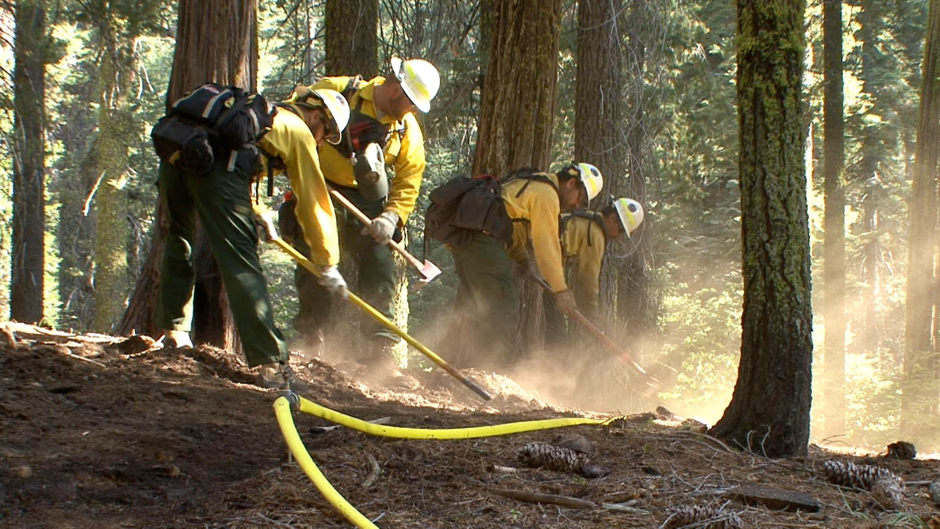
Photo courtesy U.S. Forest Service and National Wildfire Coordinating Group.
“We have crews out there that are digging trench like that for 16 hours a day,” Windhorst said. Fuel breaks can extend for miles. Although the Forest Service loves to talk about suppression, wildland firefighting is less a frontal attack than a war of attrition, the outcome largely determined by fuel and the whims of weather.
But even if fire managers could put out every single wildfire that sparked in the woods around Ravalli County—or anywhere else in America—they would be fools to do so. And it would likewise be folly to cease controlled burns. The Forest Service spent much of the 20th century learning what happens when you try to banish fire from an ecosystem. Decades of all-out suppression tactics backfired; no fires meant lots and lots of fuel in the woods, so fires got bigger and more unwieldy. Episodic fire is critical to total forest health; without frequent, moderate-intensity fires to burn dead brush, the forest turns into a tinderbox primed for massive infernos instead.
Rick Floch, the fire management officer for the Bitterroot National Forest, explained by unfurling a map of the region’s fire history since 1960. A colossal blue bloom covered much of the page. This represented the 2000 wildfires. By contrast, the nearby wilderness areas, the Bitterroot-Selway and Frank Church River of No Return, looked like an uneven quilt. Each splotch denoted a place where a fire had been allowed to burn on its own accord. Some people would say, “‘Yeah, you burnt the crap out of the wilderness and now there’s nothing left,’” Floch said. “But what I’d say is, ‘This is pretty normal.’”
The wilderness portion of his map depicted a natural fire mosaic. It’s an ecological checks-and-balances system in which low- and moderate-intensity wildfires smolder unimpeded by man, creating a patchwork of burned and unburned forest. In a healthy forest, flames act as vultures: consuming dead vegetation that would otherwise choke the forest, but not burning so intensely that they devour all living things. Eventually, the fire runs into a previous burn—a patch on the quilt—and, bereft of sufficient fuel, is starved of energy and dies.
But this ecologically healthy quilt was wilderness area, where the Forest Service has let fires burn for ecological purposes since the ‘70s—not so in other areas. That’s where the map’s big blue spot and the colossal Bitterroot fires come in. “Nature was correcting for our firefighting effectiveness,” Floch said. “So in my opinion, as bad as it was, it was a thing that was going to happen sooner or later.”
The problem isn’t just ecological. The social and psychological effects of last century’s failed suppression policies can’t be underestimated. At the south end of Ravalli County, where the foothills close in on either side of the highway, Margie Mikesell’s parents lived for 50 years without worrying about forest fire. The Forest Service suppressed and suppressed and suppressed—and then it couldn’t. So when Mikesell and her husband took over the family land in 1997, they were in for a shock. The 2000 fires came so close to their house that the heat melted neoprene gaskets off her roof. It didn’t make sense to Mikesell. “A person certainly should be able to live here without worrying about fire,” she said.
We’ve convinced ourselves it’s true: that fire, the wildest of elements, can be managed. Writing in the journal Frontiers in Ecology and the Environment, researchers Geoffrey Donovan and Thomas Brown compared aggressive wildfire suppression to flood-control efforts. Just as levees encouraged development in flood-prone areas, they argue, successful wildfire suppression promoted settlement in fire’s path. So now when a wildfire breaches a public forest’s boundary, there’s a greater chance of catastrophe because we’ve put so many buildings and people in the way.
Montana already ran out of firefighting dollars once, in 2007, forcing the governor to call a special legislative session to release emergency funds. Global warming is expected to heighten the budget problems. Headwaters Economics, a Bozeman-based think tank, estimates that unabated development combined with an average spring and summer temperature increase of just one-degree Fahrenheit could turn the state’s existing $28 million firefighting bill into an $84 million annual burden. It’s a lot of money for a state with less than one million residents.
National budgets have ballooned as well. Wildland firefighting appropriations to land management agencies averaged $2.9 billion in recent years, more than double the annual figure in the late ‘90s, according to the U.S. Government Accountability Office. “It amounts to a massive federal subsidy that sends the wrong message to homeowners and county commissioners that it’s okay to build anywhere,” said Ray Rasker, the executive director of Headwaters Economics.
In other words, with the feds and states paying for disasters, local leaders have no real reason to limit building in the WUI. In Ravalli, zoning is voluntary, and voters struck down a growth policy in 2008. A former planning staffer called the county “one of the least regulated places in the nation.”
Along with local reticence to restrict growth comes tremendous public pressure to fight wildfires with every resource available and to win, no matter the cost. In Ravalli, following the chaotic 2000 fires, a group of homeowners sued the Forest Service, claiming a backfire set by firefighters—rather than the main blaze—destroyed their houses. Never mind that their property sat in a narrow, wooded canyon accessed by a bridge too narrow and too weak to support a single fire engine.
Which makes it reasonable to suspect that fire managers more often overreact—and consequently overspend—when fire enters the wildland-urban interface. Nobody wants to see people lose their homes. And no land manager wants to be the guy who didn’t do enough.
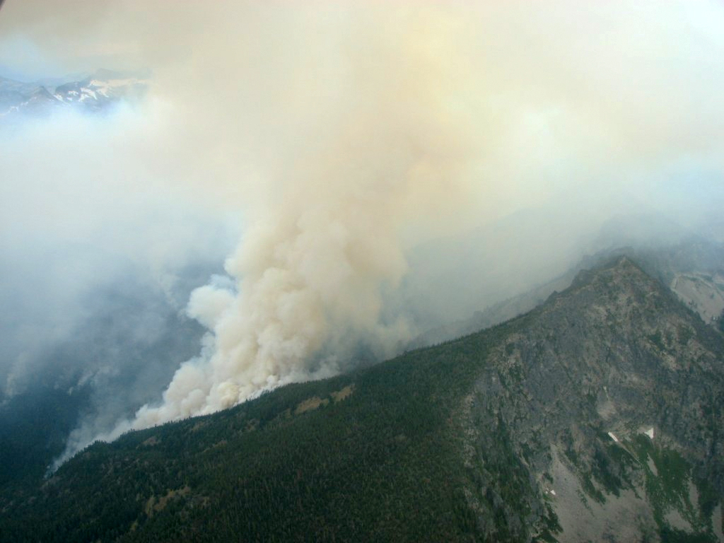
Photo courtesy U.S. Forest Service and National Wildfire Coordinating Group.
Floch, the Bitteroot fire management officer, recalled a forest fire that skirted a ridge south of Hamilton and made a dash toward neighborhoods in the grassy valley. The smart move would have been to get in position to protect the buildings and just wait until the fire dropped out of the woods and onto the grass, where it would be easy to put out. Instead, the incident commander called in helicopters and fire retardant planes from Missoula. “So in one afternoon, he probably spent close to a million dollars that had really no effect on the fire,” Floch said. “But it looked good to the people, like we were trying.”
When I started interviewing firefighters, I kept asking what I now recognize as a dumb question: “How did you put the fire out?” Usually they didn’t. The massive Bitterroot wildfires of 2000? “We ran out of summer,” Floch said. The end of the contentious Kootenai Creek blaze? “We got rain,” Ritter said. Success hinges on the weather. So what happens when summer doesn’t end on time? Or if reduced snowpacks leave the woods dry come spring?
Already, the shawl of snow covering the Northern Rockies is shrinking. By 2030, scientists expect the annual snow window will decrease by two months. In turn, wildfires will likely become bigger and more frequent, and rage in irregular patterns. Vicious cycles may follow. Consider the pine bark beetle, responsible for killing once-healthy trees, leaving slopes brown and ready to burn. Warm weather favors the pest, which ravages the trees, which become snags, which become more vulnerable to fires, which become harder to fight because it’s so hot.
If global warming looms—and the vast majority of scientists agree it does—then places like Ravalli might be anxious to prepare. Experts predict the acres-burned tally this decade to soar to 10 to 12 million acres each year, up from an annual average of 3.78 million acres in the ‘90s. Of course, if you don’t believe in global warming, you’re less likely to think about prevention. “For every report I’ve seen that man is the cause of warming, I’ve seen another that completely debunks it,” Foss said. As many as 35 percent of Americans share her skepticism: Global warming’s effects will never happen, they think, or at least not while they’re alive.
By fall, Foss had swept into office on a wave of conservative anger. Outgoing county commissioners pushed the map-based subdivision regulations through in their final hours. One of the first things Foss and her fellow conservative commissioners did was repeal them. Commissioners hired a new leader for the planning department and drafted new subdivision rules. Among other things, they specified that no development could be denied solely because it’s located in the wildland-urban interface. Bonney’s map was never approved.
What would it take to break the cycle of building and extinguishing? Despite a staggering amount of scientific literature, of fancy maps and sophisticated climate models, concrete solutions remain scarce. The Forest Service focuses on reducing hazardous fuels and on persuading homeowners to voluntarily create “defensible space” that increases a home’s chance of surviving a moderate intensity wildfire. (And, increasingly, as funds grow scarce, it concentrates on suppression.) Relying on individual homeowners to act responsibility won’t suffice as wildfires become more common and more destructive. Mechanical thinning, often proposed as a solution, can’t work on its own because the forests are too vast.
Headwaters Economics has argued that existing efforts to control costs and prevent loss of property and life will be meaningless unless the federal government involves itself in land-use patterns. The organization has proposed billing counties for their share of firefighting costs in recently developed high-risk areas, creating a disincentive for irresponsible expansion. Maybe municipalities and counties would be more concerned if they had to foot the escalating firefighting bills shouldered by state and federal governments. Likewise, some of the billions allocated to suppression might be used proactively to buy land easements and help counties pay for growth plans. Or the feds might create a national insurance program linked to sound ordinances and development, like the National Flood Insurance Program.
And we have to change the way we think about wildfire. The belief that fire is solely destructive marks a departure from our history as humans, as fire historian Stephen J. Pyne notes in Fire in America. We have little use for fire unless it’s aesthetic (the flame in the fireplace) or hidden (the spark in the combustion engine). Yet our forebears spent their lives fearing and revering fire. The flame provided light against darkness, a warm hearth on which to cook food, and a safe path through the forest.
Can environmentalists learn to value and protect wildfire in the same way we respect pristine watersheds and endangered animals? Can we think about fire as needing its own habitat, as does the wolf and the bear? Fire’s ecological role is likewise precious, and as we build into the forest, wildfire has less space to roam. “I think the biggest misunderstanding is that wildfires destroy forests, so firefighting saves forests,” said Timothy Ingalsbee, the executive director of Firefighters United for Safety, Ethics and Ecology. “That’s the shift that needs to happen. Wildfires under appropriate conditions sustain forests.”
On my last day in Ravalli, I met Jim Miller, a plant biologist and environmental activist, and his old dog, Harley, and hiked a trail along Mill Creek. Fire had burned here ten years earlier, running south to north, dropping into the granite canyon and then racing up the other side. Our path was not barren. As we hiked, Miller pointed to plants that had sprung from the ashes, “You got the pine and the fir and service berry, dogwood, huckleberry all through here, woodrose, nice native grasses, poplar, aspen. It just keeps getting better.” The young growth makes ideal food for elk, deer, and moose.
We saw fireweed, the classic post-fire bloom, a slender green shoot with purple blossoms. “And this plant is really interesting,” Miller said, pausing in front of the waxy-leafed aromatic, Ceanothus. “This is a really important pioneer plant after wildfire because it fixes nitrogen in the soil. It’s preparing the forest for the next generation of trees that are moving in.”
Miller has walked this trail countless times; he walked it after the fire, when ashes blanketed the ground like snow. An old ponderosa survived, but little else. The shadow casters—the Engelmann spruce and Douglas fir—all burned. “I thought this area was hit so hard,” Miller said. “There wasn’t a living pine tree. Now look at what we have. The diversity is probably ten-fold of what it was before.”
On an intellectual level, Miller knows this regeneration is part of the natural order. But he sounded astonished nonetheless. Aspens already stood above our heads and busy birds darted above the growth. This too was fire’s aftermath. We paused at the surviving ponderosa that Miller calls Grandfather Tree and marveled. Then we turned back, heading east, toward the valley and the houses below.
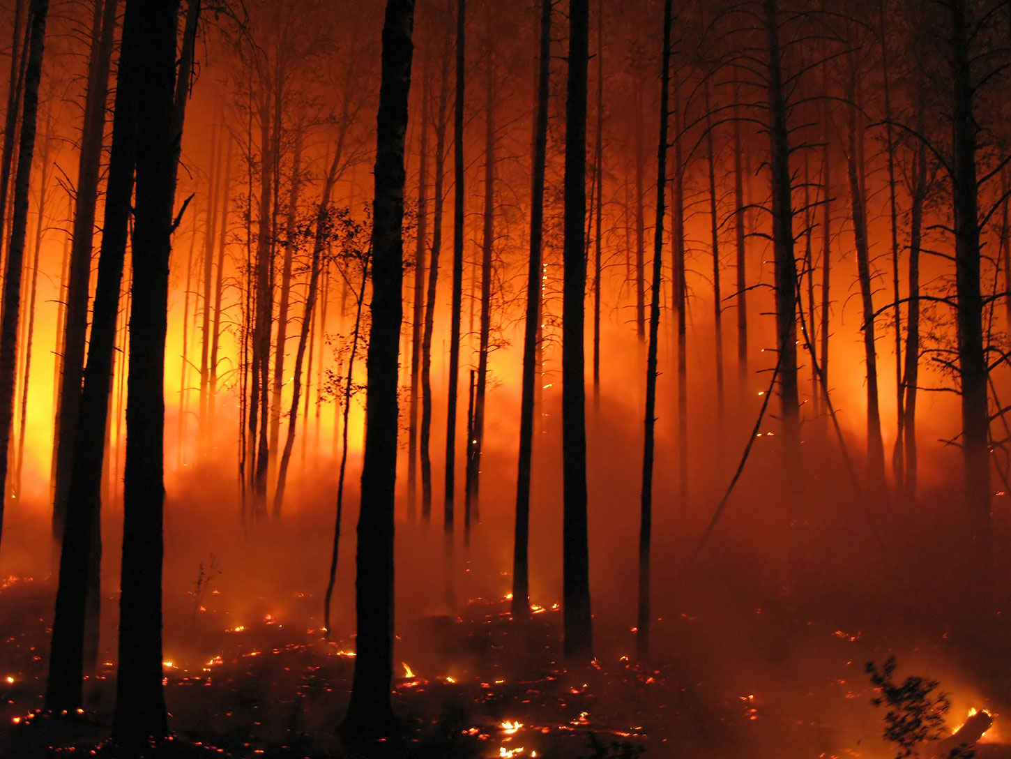
Forest fire photo by Evgeny Dubinchuk, courtesy Shutterstock.