
A Globally Unique and Threatened Inland Archipelago
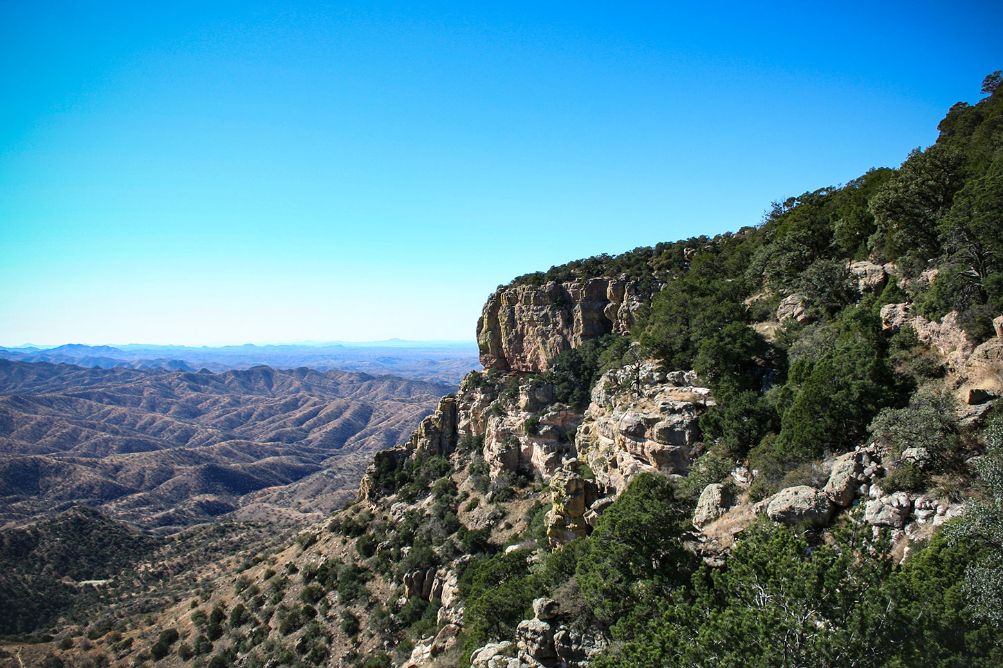
FFrom atop a mountain peak in southeastern Arizona, one’s gaze falls upon a folded fabric of earth that strikes awe, resonates beauty, and hosts one of the most biologically diverse corners of the world. Neither desolate desert nor expanses of scrubland occur here. It is a place of subtropical oaks, soaring pine-clad cliffs, and undulating hills of grassland and forest.
The Madrean Archipelago of the North American continent is a globally unique region where several major biological provinces overlap, creating an explosion of life found nowhere else in the world. Commonly referred to as the Sky Island region, this territory of isolated, forested mountains surrounded by seas of grassland tells a fascinating story of evolutionary convergence and unparalleled diversity. Its native inhabitants include jaguars, thick-billed parrots, grizzly bears, Mexican gray wolves, and other species of wildlife not generally associated with such a geography. Some of these wildlife populations teeter dangerously close to blinking out, and many require the intervention—or deliberate non-intervention—of humans to survive today’s conservation challenges.
Biogeography of the Sky Islands
One hundred miles north of Tucson, Arizona, the massive bulk of high country called the Colorado Plateau and Rocky Mountains jut into central Arizona and western New Mexico with iconic snow capped peaks and montane rivers. These thick forests and deep canyons form the Mogollon Rim, which signifies the abrupt edge found on the Plateau’s southern flank. The largest continuous stand of ponderosa pine in the world is found there, hosting the last bulwark of temperately inclined constituents before precipitously giving way to a more broken country of mountains and valleys below.
In the opposite direction—150 miles southeast of Tucson—the other mountainous spine of North America, the mighty Sierra Madre Occidental and its subtropical forests of pines and parrots gives way just before reaching the Arizona-New Mexico border. Here, an entirely different set of ecosystems have evolved over the millennia, adapting to warmer temperatures and strong connections to the western Hemisphere’s tropical latitudes.
Between and connecting these two massive continental backbones, 40 distinct mountain ranges form the Sky Island region of North America. This globally unique convergence—the north-south overlap of two major cordilleras spanning the temperate and subtropical latitudes—begins to form the foundation for ecological interactions found nowhere else on earth. To add to this special connection, an additional biogeographical phenomenon occurs at the Sky Island intersection, as well.
Spanning the lower elevations of western Arizona and northwestern Mexico, the Sonoran desert and its iconic towering saguaro cacti creep eastward into higher elevations. Tucson, which sits at the eastern edge of the Sonoran desert, marks the western gateway into the Sky Islands. East from there, the Sky Island landscape increasingly represents the cold-adapted constituents of the Chihuahuan desert, which spill westward over the lowest point in the continental divide from southcentral New Mexico and Chihuahua, Mexico.
These two major bioregional convergences—the north-south span of the temperate and subtropical along with the east-west overlap of the Chihuahuan and Sonoran deserts—set the stage for an eruption of life. This intermingling of bioregional edges brings together different life forms evolved from vastly different places on the continent, finding themselves tucked together in unusual associations within the Sky Islands.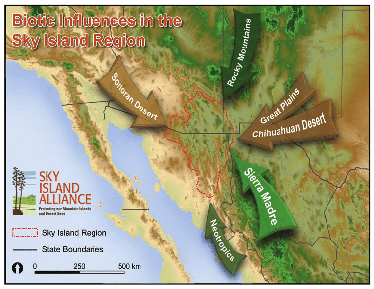
Topographical Complexity
Athird factor plays into the mix as well, providing for those unusual associations to be fully expressed. Naturally, lower elevations are hotter and drier, while higher elevations are cooler and wetter. Valley floors within the Sky Island region vary between 2,500 and 4,500 feet, while the isolated mountains peaks reach 6,000 to 11,000 feet. With 40 distinct Sky Island mountains to choose from, each providing up to 6,000 feet of elevation gradient from valley to peak within a matter of several miles, the mountains provide ample opportunity for many different species to take hold. This is especially true considering the smorgasbord of converging bioregions.
Consider the tallest of Sky Islands, the Pinaleño Mountains of southeastern Arizona, rising to 10,720 feet above the Gila River near the town of Safford. Beginning at the valley floor on the banks of the river, one walks among irrigated cotton fields surrounded by typical Sonoran desert—saguaro and cholla cactus, ocotillo, and acasia bushes lying in wait to stab you with their thorns. In just a ten-mile hike toward the peak, one travels through no less than eight distinct zones: desert, arid grassland, chaparral, pinyon-juniper woodland, Madrean evergreen oak woodland, Ponderosa pine forest, mixed conifer stands of Douglas fir and white pine, and eventually a true spruce-fir forest with burbling creeks and quaking aspens. Depending on which slope or aspect one chooses to ascend, microclimates throw curveballs into the mix, too. This creates all kinds of goofy blends of life, such as a saguaro cactus sitting opposite to a pine tree on an east-west canyon.
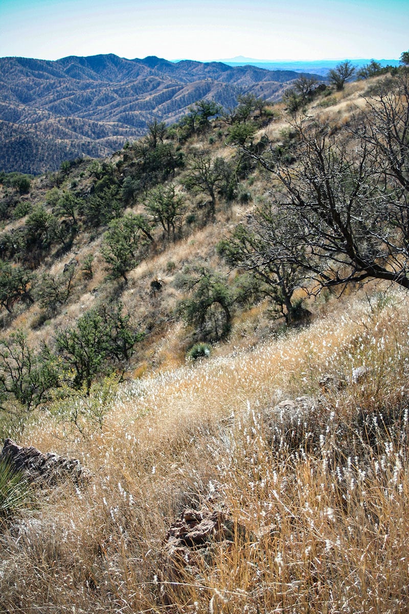
Photo by Simmons Buntin.
Biodiversity
While large information gaps exist in our knowledge of the Sky Islands, particularly in the Mexico portion of the bioregion, several indices are known.
For instance, one mountain in the Sky Island region hosts more than half of all the bird species found in the United States. Tens of thousands of visitors flock to small towns like Bisbee and WIllcox, or to remote canyons such as California Gulch and Clanton Draw to glimpse the rare eared quetzal, flame-colored tanager, gray hawk, and scores of other species that occur nowhere else in the nation. On the San Pedro River southeast of Tucson, the last major free-flowing waterway in the southwest and a critical migratory flyway, the bird diversity rivals that of tropical forests in Central America.
Less well known is the fact that the Sky Islands also host the greatest number of mammals in the U.S., as well. Javelina, coati, bighorn sheep, black bear, black-tailed prairie dogs, and many more make their home here—more than double the number of species found within Yellowstone National Park. In recent years, the jaguar and ocelot have returned, or perhaps discovered again after several decades of absence. Bee, reptile, and ant diversity is unparalleled here too, speaking volumes about the subtropical influences within the region.
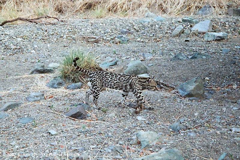
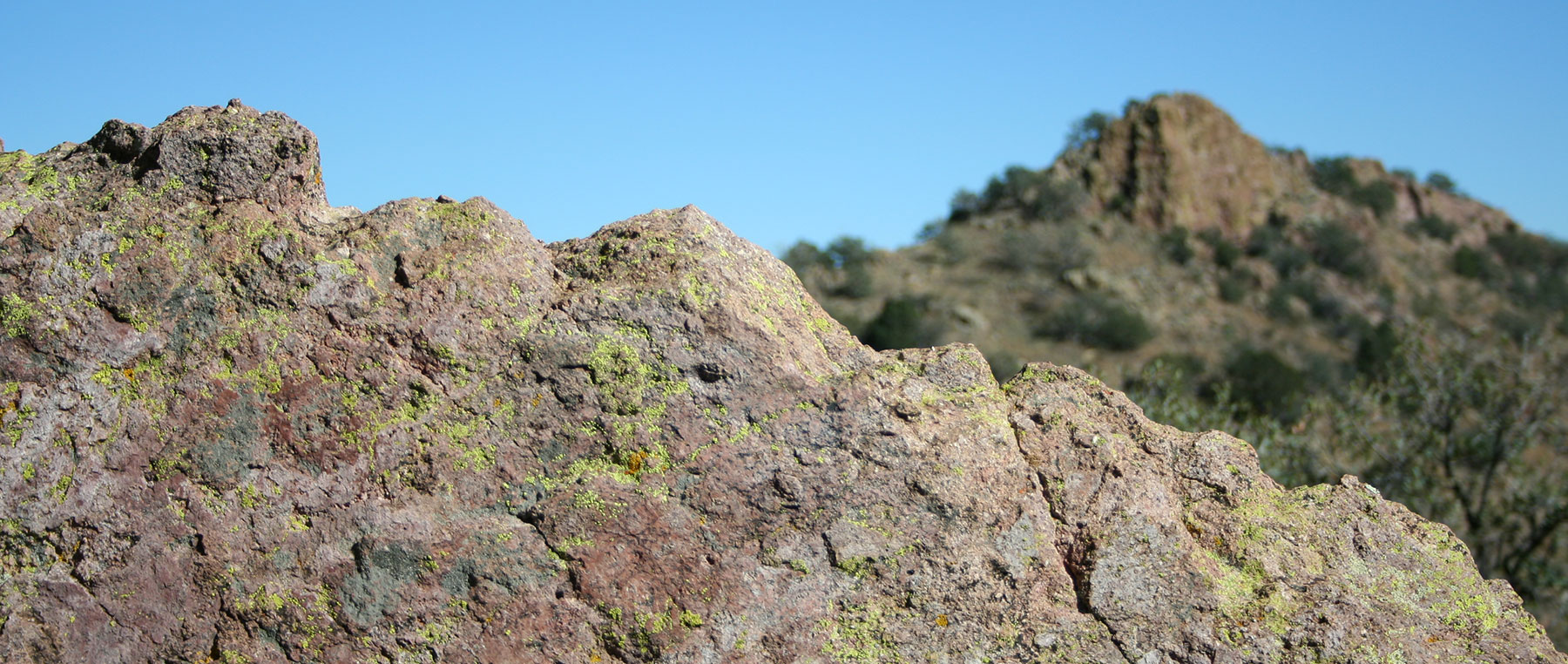
Photo courtesy Sky Island Alliance and Rancho El Aribabi.
Conservation
With the theater set and the actors revealed, the ecological play within the Sky Island region is complex, diverse, and fragile. How does all this ecological complexity interact with the human element upon the landscape?
Unfortunately, today the stage is being dismantled piece by piece. The greatest threat to the region’s natural heritage is not unlike that which plagues our planet’s other biodiversity hotspots—habitat loss and fragmentation—though it’s progression of degradation is occurring at breakneck speed here.
Historically, species decline, extinction, or extirpation (local population extinctions) often came at the hands of government trappers and hunters, aided by a general societal conviction that wolves, bears, wild cats, prairie dogs, and many other species should be done away with at every opportunity. At one time, the idea was that these “vermin” stood in the way of agricultural development, and should be removed to make the area safe for colonization. From roughly the early 1800s through the middle 20th century, it wasn’t so much that habitat didn’t exist to support populations of native wildlife as it was that full-scale persecution brought their numbers to all-time lows.
The U.S. and Mexico crusades against the Apache Indian culminated in 1886 with the capture of Geronimo and his remaining band, then cattle grazing and mining safely moved in and took their toll on the region’s grasslands and woodlands. The ecological effects of the late 1880s and early 1900s are still felt today, though most scientists agree that, comparatively, today’s landscape is healthier than it was then. Except now, new and direr threats appear.
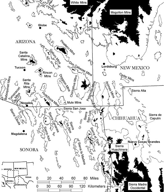
Graphic courtesy Sky Island Alliance.
Today’s Challenge
Arizona overtook Nevada as the fastest growing state in the nation in 2007, adding more than 200,000 new residents (net) every 365 days. Urban cores are undefined and growth continually spills into the wildlands, creating additional expansion and dependency on transportation infrastructure. The U.S. Sky Islands are constantly becoming more isolated from one another by roads, freeways, and rooftops, disrupting the natural movements and migratory patterns of much of the region’s native wildlife. The Mexican portion of the Sky Islands remains more static, though illegal logging and the drug trade near the border take their toll. The conversion of wildlands to development is a relatively new phenomenon, though its sheer pace elicits alarm from conservationists working within the region.
Questions that must be answered soon include: how important landscape connectively is maintained for wildlife as low-traffic rural routes are converted to four-lane freeways, how plant and animal communities adapt to a hotter and more arid environment due to climate change, and what implications the construction of an impermeable border wall between the U.S. and Mexico have on this internationally connected ecosystem.
The future is uncertain, though hope remains for these mountain islands and grassland seas. The opportunity for ensuring the Sky Island region’s natural heritage remains intact for future generations lays in the same fundamental arena that drives the challenges placed upon it. This arena is responsible land-use planning at a regional and local level. When distilled, these land-use decisions are ultimately driven by local constituencies, providing a comprehensible angle of approach for solution-based strategies. Whether its global climate change, national energy use, or regional wildlife corridor needs, many of the choices before us involve how and where we live. State and local land-use planning must recognize the value of ecosystem services, natural landscape connectivity, and the benefits of an intact ecosystem to humans and non-humans alike. When that occurs, decisions on how and where to accommodate growth, development, and infrastructure will be better informed and our current environmental debt will be lessened. Even on federally owned land, which is tied to core sets of national policy, local constituencies have considerable latitude in how policy is prescribed and followed. In the Sky Island region, hope lies with the local constituents who are currently beginning to redefine how land and wildlife conservation must act and react to the growing pressures.
Header photo by Simmons Buntin.